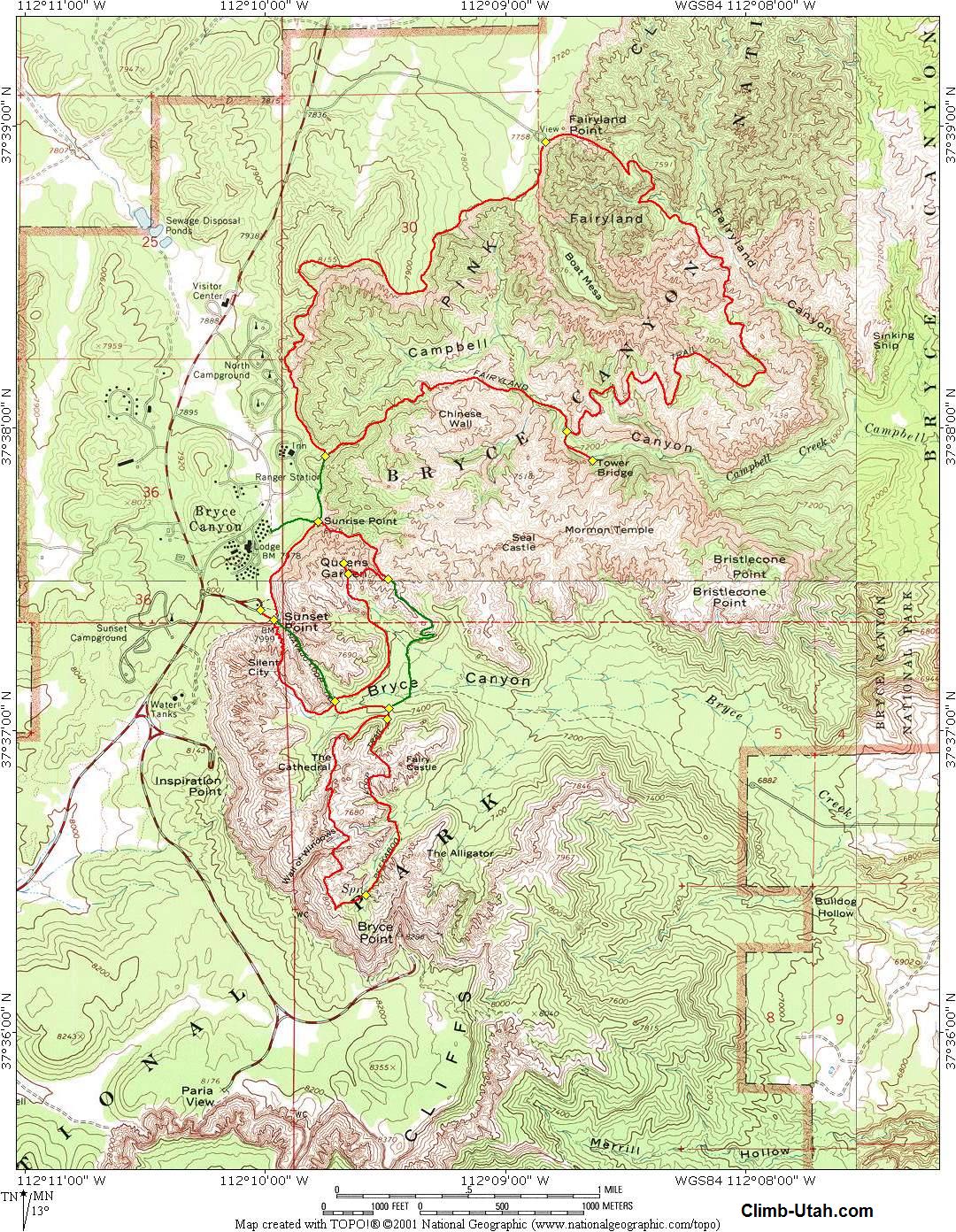
The Fairyland Loop hike is not as crowded as other trails in Bryce Canyon National Park, which adds to it's appeal. The route is 8 miles long and will require about 3 1/2 hours for the average hiker to complete. This time estimate includes a short side trip to Tower Bridge. The trail is extremely well maintained and signed. This trail loses 950 feet of elevation as it drops to it's low point and than climbs 950 feet as it returns to the rim. I consider September and October to be the ideal time to hike this loop. The trail is snow covered in winter. Navigation for this route is very simple. Map reading skills are not really required for this adventure because all trails are very well marked and signed. The USGS 7.5' Map titled "Bryce Canyon" shows the route described. For the financially challenged this hike offers a small bonus. The turn-off for the Fairyland Trailhead is 200 yards inside the park boundary but before the fee station. In other words, it's free to hike this loop. If you are camping in Bryce Canyon at the North Campground you will recognize that it is more advantageous to begin this hike along the Rim Trail, just hike a short distance east of the campground on any number of hiker paths until you intersect the Rim Trail. Beginning this hike from Sunrise Point is also very popular since Bryce Canyon began a shuttle system. The shuttle currently stops at Sunrise Point but not at Fairyland Point.
From the Bryce Canyon Visitors Center follow State Road 63 north for 1.0 miles to a signed junction. Turn right (east) and follow the road for 1.0 mile to the signed Fairyland Trailhead.
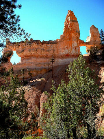
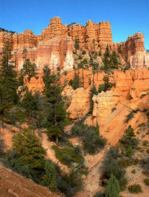
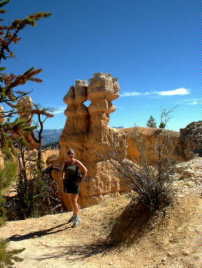
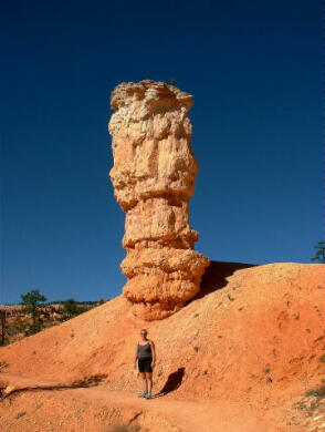
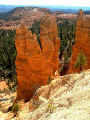
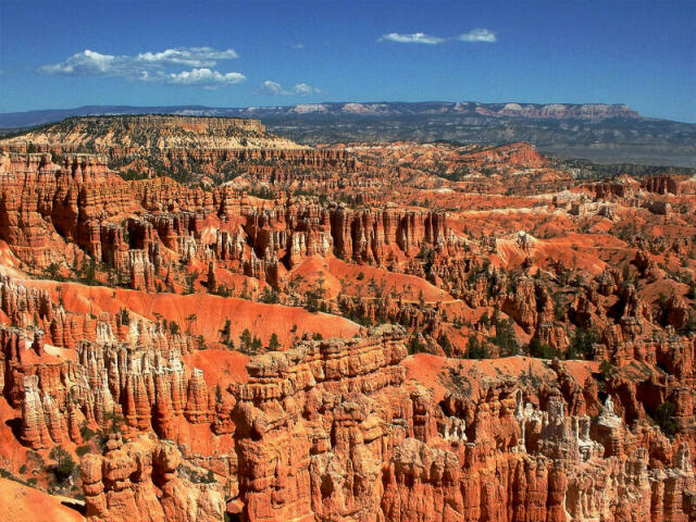
From the Fairyland Trailhead follow the trail east, over the rim as it snakes it's way down the north side of Boat Mesa and into Fairyland Canyon for 1.5 miles to the low point on the loop. Fairyland Canyon is positively fabulous. From the low point the trail begins to climb out off Fairyland Canyon and offers outstanding views of Sinking Ship Mesa, which certainly looks like a huge ship sinking. Keep following the well maintained trail for an additional 2.5 miles along the toe of Boat Mesa until you reach the signed Tower Bridge junction. Take the time to tramp down the trail 200 yards and visit Tower Bridge. Since you are approximately half way around the loop this is a majestic spot to take a break and enjoy a snack before returning to the main trail. From the Tower Bridge junction the trail begins to wind it's way 1.5 miles back to the canyon rim. The trail climbs out of Campbell Canyon and as you reach the ridge you will be presented with a great view of the Chinese Wall on your left. Just keep following the trail to the canyon rim. At the rim the Fairyland Trail intersects the Rim Trail. Turn right (north) and follow the Rim Trail for 2.5 miles back to the Fairyland Trailhead. The Rim Trail offers good views into upper Campbell Canyon.
© Copyright 2000-, Climb-Utah.com |