 Visiting Butler Wash Ruins will
require 1 hour to complete. The route involves easy hiking and no route finding
skills. The trail is signed and is well maintained. This is a great hike for
beginners, seniors and children. I suggest you bring along binoculars for a close up
view of the ruins. The ruins are best photographed in the morning when they are well
illuminated by the early sun.
Visiting Butler Wash Ruins will
require 1 hour to complete. The route involves easy hiking and no route finding
skills. The trail is signed and is well maintained. This is a great hike for
beginners, seniors and children. I suggest you bring along binoculars for a close up
view of the ruins. The ruins are best photographed in the morning when they are well
illuminated by the early sun.
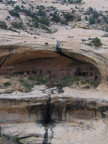
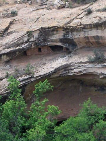
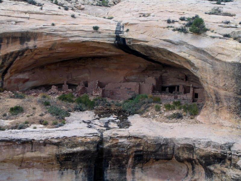
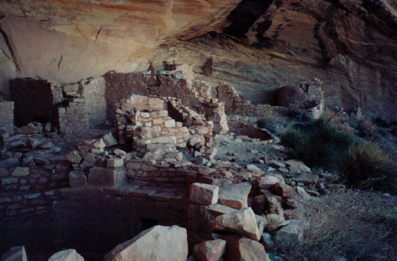
The cliff dwellings in this area were built and occupied by the Anasazi about 1200 A.D., the structures represent daily life with living and storage rooms, along with ceremonial chambers. The Butler Wash site has been reconstructed and stabilized to some degree and contains four kivas. Kivas are underground chambers where ceremonial activities were held. Three of the kivas are of the round, Mesa Verde type most common in this area. The fourth is square, indicative of the Kayenta culture to the south in Arizona. A GPS is not required. Navigation for this route is easy. Map reading skills and the USGS 7.5' Map titled "Hotel Rock" are not required. All waypoints and maps use the WGS84 datum.
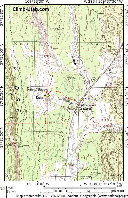
The trailhead to the Butler Wash Ruins is located on Utah Highway 95. From Blanding, Utah travel south on Utah Highway 191 for 3 miles to the junction of Utah Highway 191 and Utah Highway 95. Travel west 10 1/2 miles on Utah Highway 95 to mile marker 110.9 and the signed parking lot and trailhead for Butler Wash Indian Ruins. There is paved parking and a pit toilet at the trailhead.
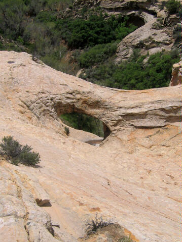
From the signed Butler Wash Ruins Trailhead (N37° 31' 27", W109° 37' 57"), follow the well maintained trail west for 1/2 mile to the signed Butler Wash Viewpoint (N37° 31' 31", W109° 38' 20"). Actually visiting the ruins involves a small amount of rock climbing and is highly discouraged. From the signed viewpoint there is a great natural bridge (N37° 31' 33", W109° 38' 22") about 100 yards north in the main drainage. The natural bridge is not visible from the viewpoint but is easy to locate if you hike 100-yards north on the slickrock ridge the viewpoint is located on.
If you enjoyed the Butler Wash Anasazi Ruins than consider visiting Mule Canyon Indian Ruins which are 8 miles west of Butler Wash Ruins. Mule Canyon Ruins are a roadside stop or a 10 mile hike, whichever you prefer. © Copyright 2000-, Climb-Utah.com |