 Fry Canyon is a technical canyoneering
adventure. This adventure will require 3 hours to complete. You will need a 50-meter
rope. I recommend carrying several slings, 50 feet of webbing, and several rappel
rings or 5/16 rapid-links. A bolt kit is not required.
Fry Canyon is a technical canyoneering
adventure. This adventure will require 3 hours to complete. You will need a 50-meter
rope. I recommend carrying several slings, 50 feet of webbing, and several rappel
rings or 5/16 rapid-links. A bolt kit is not required.
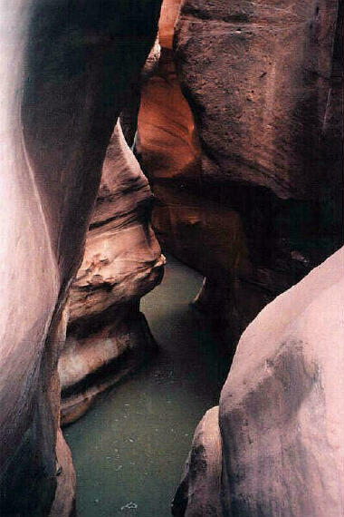
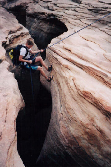
The route is easy to navigate. Jacobs Chair is the USGS 7.5 minute topographical map that shows Fry Canyon. There is one 60' rappel along with wading and swimming. A wetsuit or dry suit will only be required during cold weather. A large size group is not a problem with this route. Fry Canyon is rated 3B II using the Canyon Rating System.
Trailhead
Information:
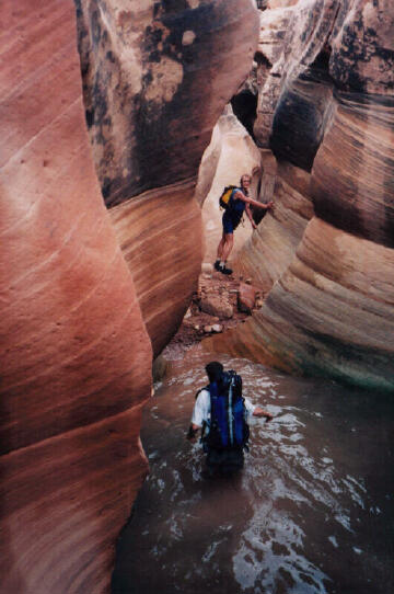
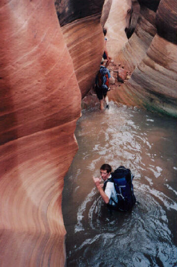
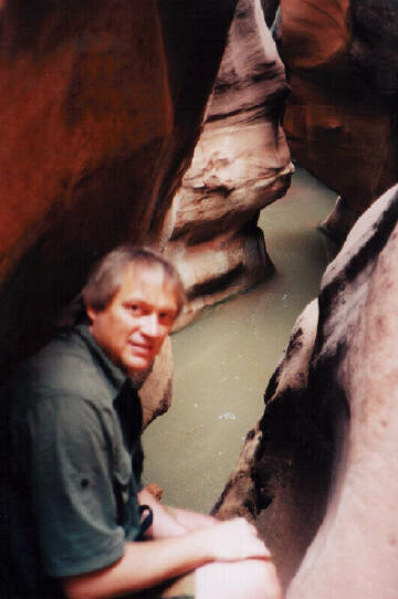
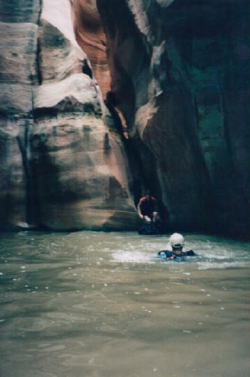
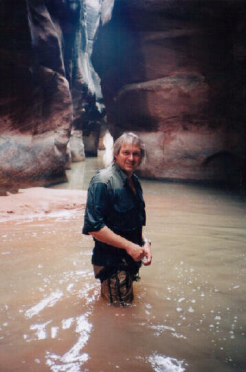
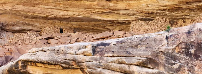
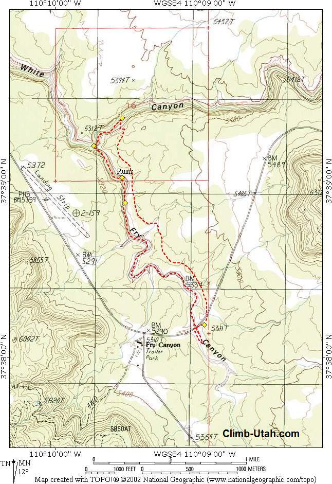
From the Trailhead (N37 38' 12", W110 08' 57"), Walk to the center of the bridge and look down into the first section of narrows. Hike upstream 1/4 mile along the west side of the narrows until you reach a fence that crosses the top of the narrows. Climb into the narrows and head downstream under the bridge. This first section of narrows involves some downclimbing and wading. After exiting the first section of narrows continue hiking down the canyon bottom for 1 1/4 miles. At the second section of narrows the route seems to just disappear into a narrow slot in the ground. There are two bolts (N37 38' 53", W110 09' 30") on the right side (LDC) of the slot. Rappel 60-feet into the narrow slot to the floor of the canyon. Next, downclimb (5.4) a 20-foot section to the deep pool below. Swim the pool, wade the canyon, swim a second pool, a little more wading and stroll to the end of the narrows. As you exit the narrows notice the excellent Indian ruins (N37 39' 01", W110 09' 32") on the right side canyon wall. From the exit of the narrows hike down canyon 1/2 mile until you intersect White Canyon (N37 39' 12", W110 09' 43"). Hike up White Canyon 1/4 mile until you encounter several cairns on the ledges on the south (right) side canyon wall. This is the exit (N37 39' 22", W110 09' 32") from the canyon bottom. Scramble to the canyon rim using the ledges to wind your way to the top. There are many cairns on the ledges that will help you navigate to the canyon rim. Once your out of the canyon just follow the hiker made rim trail back to the trailhead.
© Copyright 2000-, Climb-Utah.com |