 Visiting Cave Tower Ruins requires a short walk. Please
take only pictures and leave only footprints. A
round trip to visit and explore the ruins will require approximately 1 hour. The actual
hiking part of the route is only 100 yards if you drive all the way to the trailhead.
These ruins should be easily accessible to just about everyone.
Visiting Cave Tower Ruins requires a short walk. Please
take only pictures and leave only footprints. A
round trip to visit and explore the ruins will require approximately 1 hour. The actual
hiking part of the route is only 100 yards if you drive all the way to the trailhead.
These ruins should be easily accessible to just about everyone.
A GPS is useful in verifying you are on the correct route. The is no trail to follow while accessing these ruins. The USGS 7.5' Map titled "Hotel Rock" shows the area described. Navigation for this route is easy. All waypoints and maps use the WGS84 datum. Cave Tower Ruins is rated 1A I using the Canyon Rating System. A BLM Backcountry Permit is not required to hike Cave Tower Ruin, provided you only hike on top of the plateau and do not descend into Mule Canyon. If you climb down into the canyon then a permit is required. The closest permit station is approximately one mile away and located at the Mule Canyon Trailhead.
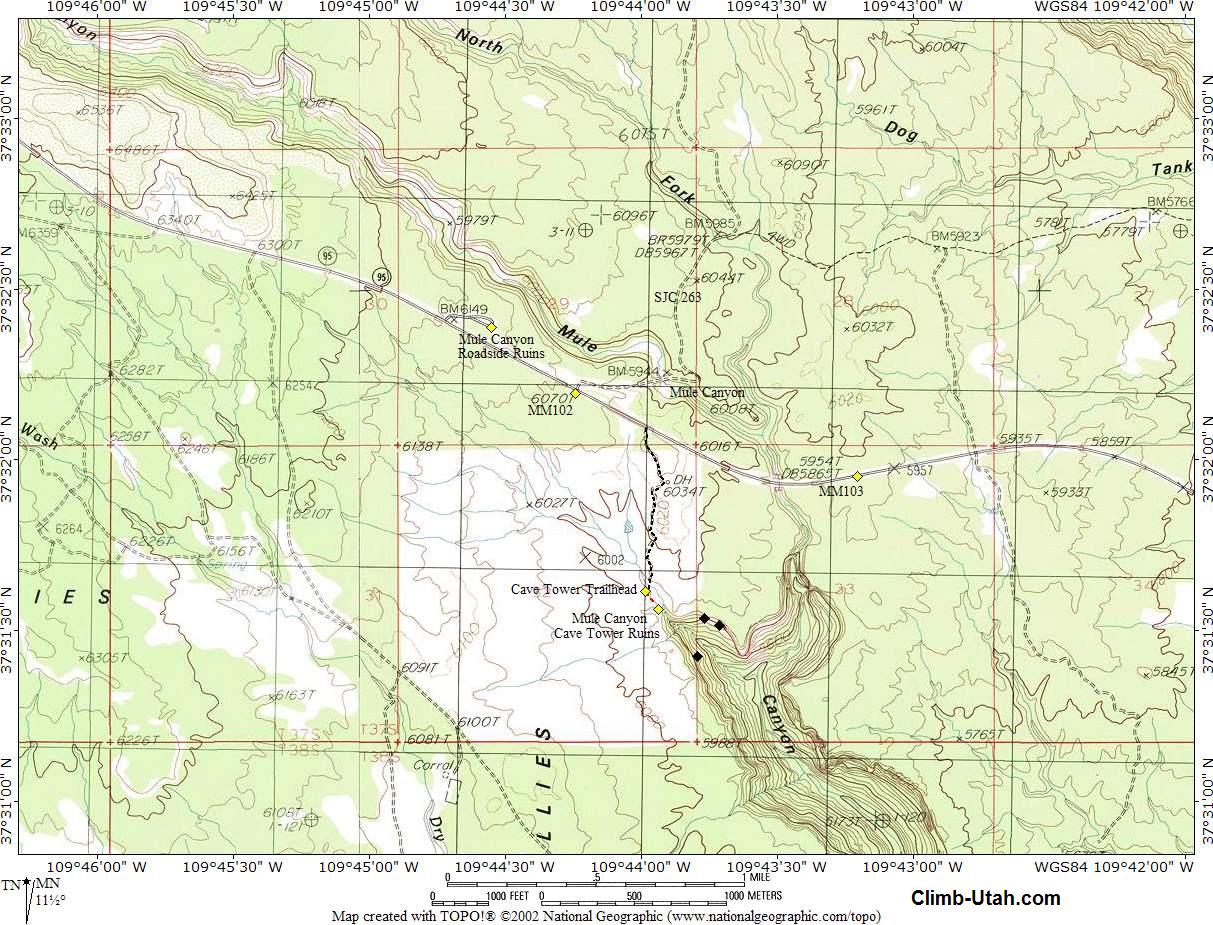
The trailhead to Cave Tower Ruins is located along Utah Highway 95. From Blanding, Utah travel south on Utah Highway 191 for 3 miles to the junction of Utah Highway 191 and Utah Highway 95. Travel west 19 1/2 miles on Utah Highway 95 to mile marker 101.4 and the signed parking lot for Mule Canyon Ruins (N37° 32' 23", W109° 44' 33"). There is paved parking and a pit toilet with a 1/8 mile concrete trail which winds around some restored ruins with information boards. Take a few minutes to explore Mule Canyon Roadside Ruins and jump back in your vehicle. From the Mule Canyon Roadside Ruins travel east for 0.8 miles on Highway 95 to mile marker 102.2. Turn south (right) on the dirt road and pass through the gate (N37° 32' 06", W109° 43' 59"), remembering to keep it closed. This dirt road is accessible to all high clearance vehicles, those with passenger cars might want to park near the gate and just walk the short distance to the trailhead. After passing through the gate follow the dirt road south for 0.5 miles to the Cave Tower Trailhead.
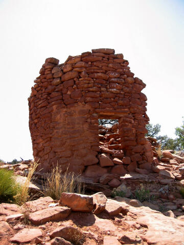
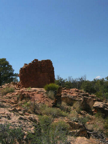
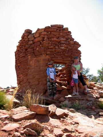
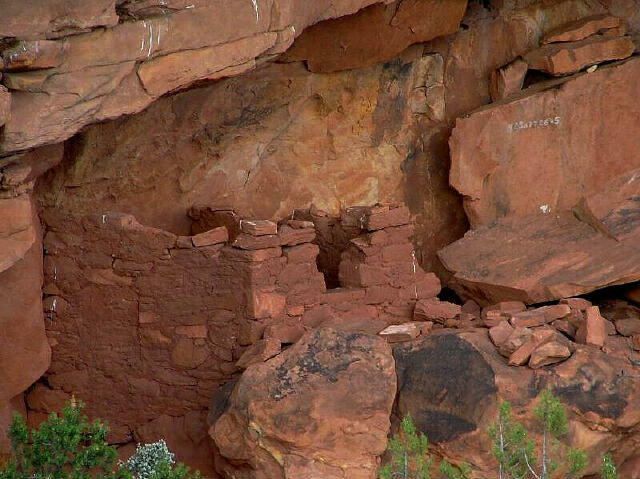
From the Cave Tower Trailhead (N37° 31' 37", W109° 43' 59") it's easiest to just walk south, and follow the shallow drainage downstream. After about 100 yards you will reach a dryfall guarded by the remains of several towers. This is the Cave Tower Ruins (N37° 31' 34", W109° 43' 56"). Three of the seven towers are easily visible, while four of the towers have collapsed. These towers are unique because only a few towers remain standing on Cedar Mesa. From the head of the canyon you can walk east and climb down to the first bench below the rim. Once on the first bench you can walk back and visit the spring and large alcove below the dryfall. If you walk east along the first bench you will discover several granary ruins. Keep walking east along the first bench and after a short distance you will discover more ruins tucked under the rim. [ Homepage ] [ Introduction ] [ Warning ] [ Ratings ] [ Ethics ] [ Feedback ] [ Updates ] © Copyright 2000-, Shane Burrows |