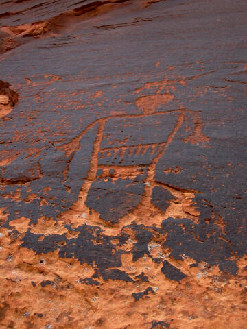
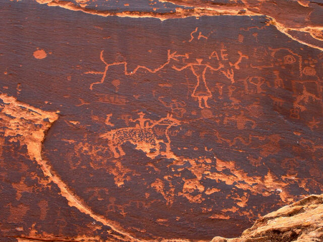
 The Sand Island Petroglyph Panel is a roadside stop.
The panel contains several hundred figures. The styles range from Archaic to fairly recent
Native American and cowboy inscriptions. The panel can be viewed from your vehicle, but if
you truly want to see the detailed figures you need to spend a couple of minutes and walk
over to the cliff. The rock art is accessible year in all weather conditions. Please take
only pictures and leave only footprints.
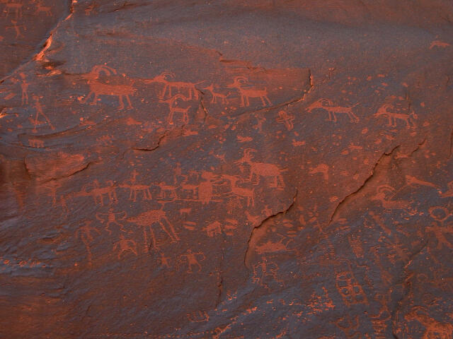
The Sand Island Petroglyph Panel is a roadside stop.
The panel contains several hundred figures. The styles range from Archaic to fairly recent
Native American and cowboy inscriptions. The panel can be viewed from your vehicle, but if
you truly want to see the detailed figures you need to spend a couple of minutes and walk
over to the cliff. The rock art is accessible year in all weather conditions. Please take
only pictures and leave only footprints.
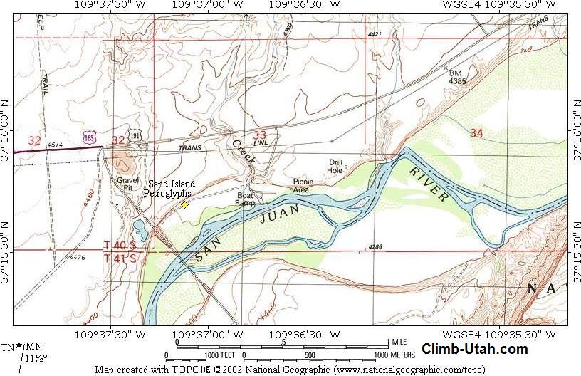
A GPS is a complete waste of time but I'll give you the waypoints because I know how much some of you like to push buttons. The USGS 7.5' Map titled "Bluff" shows the area described. Navigation for this route is non-existent. All waypoints and maps use the WGS84 datum.
From Bluff, Utah drive west on Highway 191 a little over 3 miles to mile marker 22 and the signed Sand Island State Park turn off. Turn south into Sand Island State Park and drive 0.3 miles down the road to the signed junction. Turn west (right) and follow the road an additional 0.3 miles to the signed and fenced Sand Island Petroglyphs (N37° 15' 42", W109° 37' 07") located on the north side of the road. Any vehicle can access the petroglyph panel. Camping and picnic sites are available at the State Park for a fee. Sand Island is mainly used for the boat ramp that allows river rafters to access the San Juan River.
[ Homepage ] [ Introduction ] [ Warning ] [ Ratings ] [ Ethics ] [ Feedback ] [ Updates ] © Copyright 2000-, Shane Burrows |