 Chimney Rock is an enjoyable
hike that will take about 2 hours to complete. The route is accessible year round but I
would not do the loop in summer because it would be miserably hot. You might experience
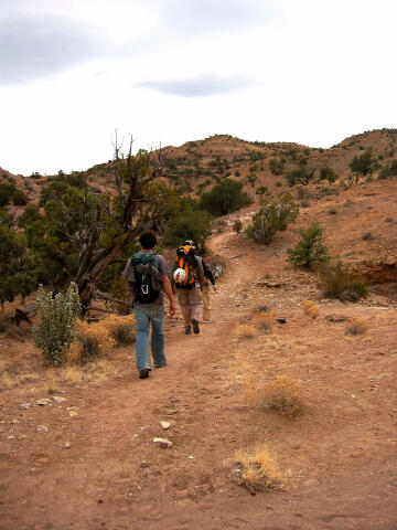
snow and mud on the route in winter. The route follows a well-maintained and easy to
follow trail. The route is 3 miles in length. Everyone in your party should carry two
liters of water.
Chimney Rock is an enjoyable
hike that will take about 2 hours to complete. The route is accessible year round but I
would not do the loop in summer because it would be miserably hot. You might experience
snow and mud on the route in winter. The route follows a well-maintained and easy to
follow trail. The route is 3 miles in length. Everyone in your party should carry two
liters of water.
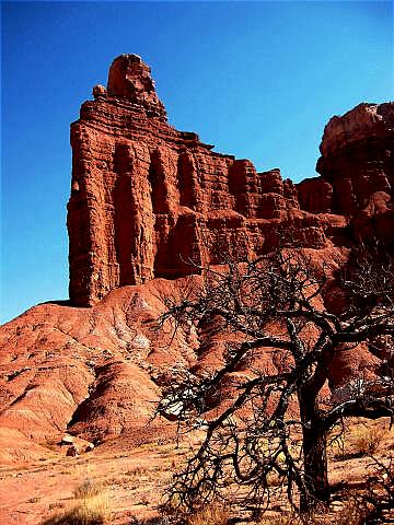
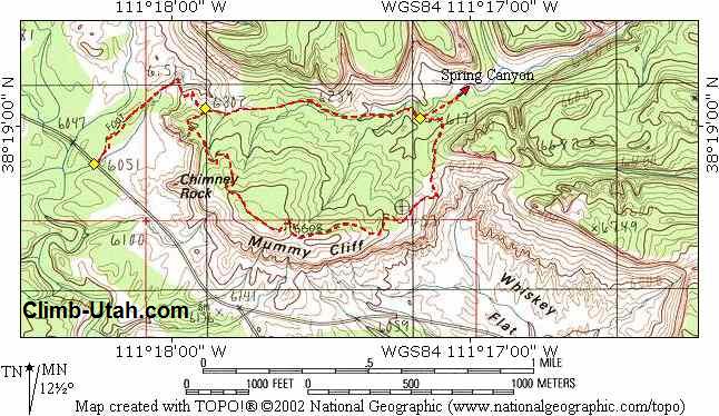
Chimney Rock Trail requires no special gear other than comfortable hiking shoes. This route is novice friendly and navigation is easy. A GPS is not required to complete this loop hike but the coordinates are provided for anyone who is a gizmo addict. Map reading skills and the USGS 7.5' Map titled "Twin Rocks" are useful. The Chimney Canyon Trail can be completed in either direction. The counterclockwise direction described below is the most popular and eliminates most of the steep climbing at the beginning of the adventure.
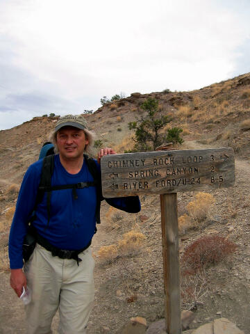
To reach the trailhead from the Capitol Reef Visitor Center take Highway 24 west for 3.1 miles to the signed Chimney Rock Trailhead located at mile marker 76.3. The trailhead has parking for a dozen vehicles and a pit toilet. Any vehicle can access this trailhead and all roads are paved. Route Information: From the Chimney Rock Trailhead (N38° 18' 54", W111° 18' 16"), the trail snakes northeast through the chocolate brown, crumpled hills of the Moenkopi Formation, a complex shale and sandstone deposit laid down by the tidal waters of an ancient sea. Follow the trail through the field of sandstone blocks and up a series of switchbacks onto the Chinle slopes. 1/2 mile from the trailhead you will encounter a junction signed Chimney Rock Loop Trail (N38° 19' 03", W111° 17' 53"). The trail to the east is the return route. Turn south (right) and continue hiking. The path climbs steeply to an overlook of Chimney Rock, where a massive Shinarump capstone keeps the Moenkopi pillar from eroding. The route continues south along the top of Mummy Cliff. Enjoy the sensational views of the reef and the Waterpocket Fold. 1 3/4 miles from the previous junction you will encounter a second signed junction (N38° 19' 01", W111° 17' 10"). The trail to the north (right) descends into Spring Canyon. Continue west (straight ahead) and in 3/4 mile you will intercept the trail you climbed earlier to reach the top of the mesa. Return to the trailhead from this point. © Copyright 2000-, Climb-Utah.com |