[
Homepage ] [
Introduction ] [
Warning ] [
Ratings
] [ Ethics ] [
Feedback ] [
Updates ]
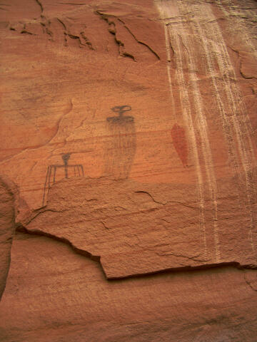 |
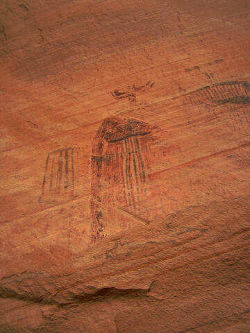
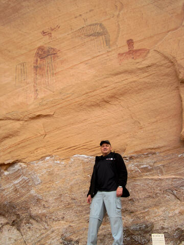
Bartlett Pictographs
Moab
Hiking & Rock Art
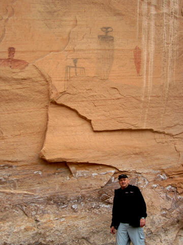
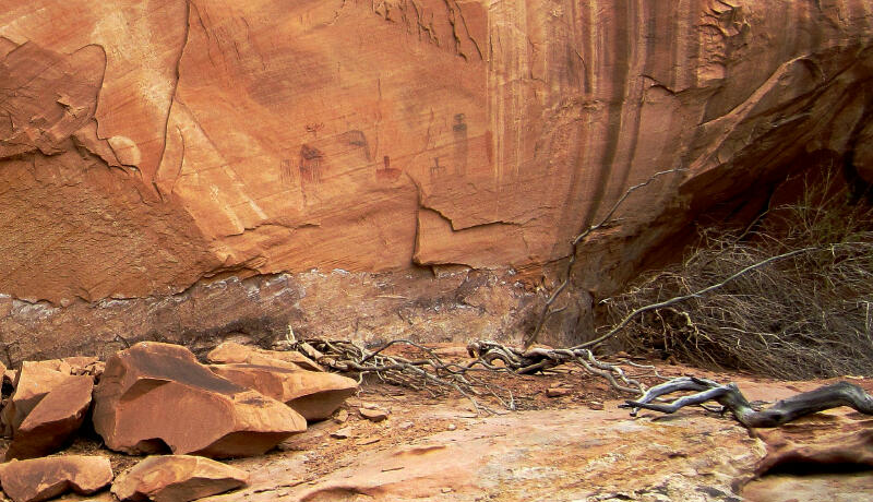
The
Bartlett Pictograph Panel is an easy adventure suitable for the entire
family. The pictographs are somewhat faded, but
are still easily
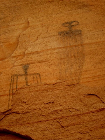
visible and worth the short trip. This collection of rock art contains a
noteworthy green alien pictograph. I have seen this green alien
pictograph used in several history shows and documentaries attempting to
prove that earth was visited by space travelers in an earlier time
period. The pictograph certainly looks like the classic Hollywood space
alien. |
General Information:
 The Bartlett Pictograph Panel is a short stroll to a very interesting panel
of native American rock art.
A round trip to visit the panel requires approximately one hour.
This is a desert environment, every member of your hiking party should carry
a minimum of at least one liter of water. Binoculars are
useful in viewing the pictographs from the trailhead for those that don't
want to walk over and see them. The rock art is accessible year
round in dry weather conditions.
The Bartlett Pictograph Panel is a short stroll to a very interesting panel
of native American rock art.
A round trip to visit the panel requires approximately one hour.
This is a desert environment, every member of your hiking party should carry
a minimum of at least one liter of water. Binoculars are
useful in viewing the pictographs from the trailhead for those that don't
want to walk over and see them. The rock art is accessible year
round in dry weather conditions.
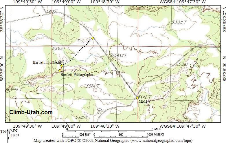
A GPS is useful in verifying you are on the correct route and
locating the rock art. The USGS 7.5' Map
titled "Jug Rock" shows the area described. Navigation for this route
is easy and there is an easy to follow trail. All waypoints and maps use the WGS84 datum.
The Bartlett Pictograph Panel
is rated
1A I using the Canyon Rating System.
 |
 |
Trailhead Information:
This
attraction is
located just outside of Moab on the road to Dead Horse Point and Canyonlands
Island in the Sky District.
From Moab head north out
of town on U.S. Highway 191. Cross the bridge over the Colorado River. After
crossing the bridge continue north for 8.3 miles to the junction with State
Road 313, signed Dead Horse Point and Canyonlands. Turn west (left) on State
Road 313 and follow it for 8.5 miles to mile marker 14.0 (N38° 37' 43",
W109° 48' 06"). Turn north (right) on the unsigned, but well-maintained,
Dubinky Well Road.
Follow the Dubinky Well Road for 0.8 miles to an unsigned spur
road (N38° 38' 19", W109° 48' 40") on the west (left) side of the
road. Any passenger vehicle can easily reach this point. Those driving cars
might want to walk from this point on as the spur road becomes sandy and has
a couple of rough spots.
Follow the spur road southwest for 0.4 miles to where the road
ends at the Bartlett Pictograph Panel Trailhead. The trailhead is signed and
easy to identify. There is parking for several vehicles at the trailhead.
Route
Information:
From the Bartlett
Trailhead (N38° 38' 02", W109° 49' 04"),
hike 150-yards south to the large alcove. The Bartlett Pictographs (N38° 37'
59", W109° 49' 05") are located high on the cliff wall in the alcove.
Video:
Enjoy a short video of the Bartlett Pictograph panel in Moab, Utah.
Please take only pictures and leave
only footprints.
[
Homepage
] [ Introduction ] [
Warning ] [
Ratings ] [
Ethics
] [ Feedback ] [
Updates ]
© Copyright
2000-, Climb-Utah.com |