[ Homepage
] [ Introduction ] [ Warning ] [ Ratings
] [ Ethics ] [ Feedback ] [ Updates
]
 |
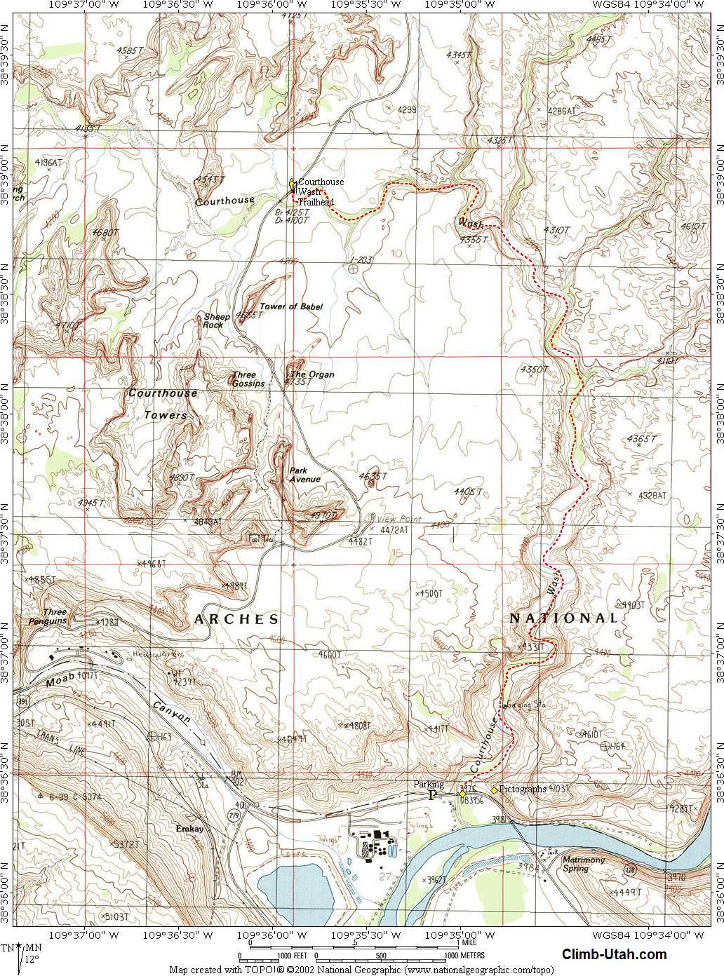
Courthouse Wash
Arches National Park
Hiking
Looking
for a nice hike not on the typical tourist menu in Arches National Park? Courthouse Wash
might be your ticket. The hike is lovely and free of the usual National Park crowds. The
route is easy to follow, requires several hours time, and follows a cheerful stream. |
General Information:
  Courthouse Wash is a wonderful
desert hike that will require 3 to 4 hours. The route is 5 1/2 miles. Elevation loss on
this hike is virtually nil at 150-feet. The
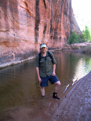
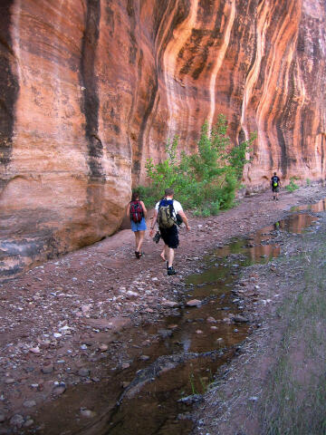
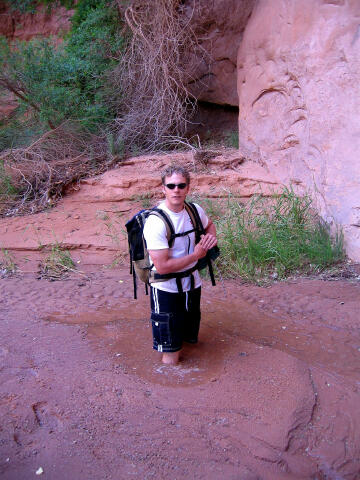
route consists of easy hiking along a sandy wash. Some minor ankle to knee deep wading
might be required depending on conditions. Courthouse Wash requires you carry a least enough water for half-a-day in the
desert. This route is rated 1B II using the Canyon Rating System.
Courthouse Wash is a wonderful
desert hike that will require 3 to 4 hours. The route is 5 1/2 miles. Elevation loss on
this hike is virtually nil at 150-feet. The
route consists of easy hiking along a sandy wash. Some minor ankle to knee deep wading
might be required depending on conditions. Courthouse Wash requires you carry a least enough water for half-a-day in the
desert. This route is rated 1B II using the Canyon Rating System.
This route should be easy for any moderately experienced hiker. Navigation
for this route should be effortless. There is no trail but the route follows a large wash
for its entire distance. Mistakes in navigation are easy to overcome and correct on this
route. A GPS is useful in identifying waypoints and verifying your location. Good map
reading skills and the USGS 7.5' Maps titled "Moab" and "The Windows
Section" are helpful. All waypoints and maps for this route use the WGS84 datum.
Courthouse Wash Facts:
Courthouse Wash was named
after the Courthouse Towers which are located about 1 mile southwest of the Courthouse
Wash Trailhead.
Trailhead Information:
The downside to this hike is that it requires a vehicle shuttle. All roads and parking
areas for this route are paved. There are no restrooms at the trailheads. The trailheads
are accessible to all vehicles in all conditions. A bicycle could be used for the shuttle,
in which case I might suggest hiking the route in reverse of what is described.
Lower Trailhead:
From Moab head north
out of town on U.S. Highway 191. Cross the bridge over the Colorado River. After crossing
the bridge continue north for 0.3 miles to the signed "Parking" on the north
(right) side of the highway. This is the Lower Trailhead. Drop your shuttle vehicle here
and continue driving north on Highway 191 for 1.7 miles to Arches National Park.
Courthouse Wash Trailhead:
From Arches National Park Visitor
Center drive into the park for 4.4 miles to the bridge over Courthouse Wash. Park at the
large, paved, pull-out on the north (left) side of the road, just east of the bridge. This
is the Courthouse Wash Trailhead. The trailhead easily accommodates several vehicles.
Route
Information:
From the Courthouse
Wash Trailhead (N38° 38' 58", W109° 35' 54"), walk over to the bridge and find
your way into the bottom of Courthouse Wash. Nothing tricky about this hike from here to
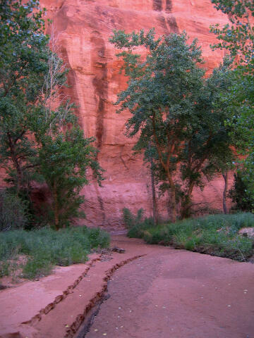
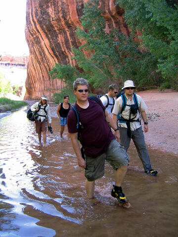
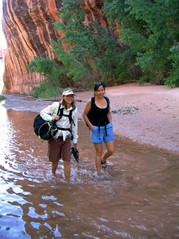
the finish. Hike downstream and enjoy the ride.
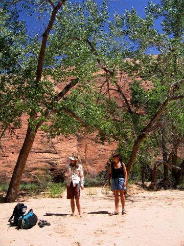
Along the
route you might enjoy exploring up several of the side canyons. My favorite side canyon is
the first on your left (north) as you hike downstream. Small areas of quicksand are also
common along this route. Nothing to serious, just a nice mud hole for the kids to play in.
The sand can
become tiring to hike in after a while and many will discover hiking in the water is more
pleasant. After several hours you will reach the Lower Trailhead (N38° 36' 25",
W109° 34' 59").
Just as you
reach the Lower Trailhead you will find a nice panel of rock art located between
Courthouse Wash and the Colorado River. To see the rock art you must walk uphill to the
base of the cliffs overlooking Highway 191. The base of the cliff has a large pictograph
and petroglyph panel. The panel is approximately 19-feet high by 52-feet long. At one time
this was an amazing panel guarding the entrance to Moab, but the site was heavily
vandalized in 1980.
Caution:
Sections of this route pass near
gardens of poison ivy. The poison ivy problem is extremely minor on this route and easy to
avoid if you know what it looks like. Poison ivy has three leaves and is frequently found
near water. Poison ivy leaves are green in the summer and red in the fall. Educate
yourself before attempting this route.
[ Homepage
] [ Introduction ] [ Warning ] [ Ratings
] [ Ethics ] [ Feedback ] [ Updates
]
© Copyright
2000-, Climb-Utah.com |