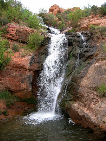
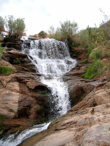
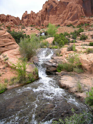
 Faux
Falls is a very short hike to a beautiful desert waterfall. The route can be
enjoyed by any adult or child. No special gear is required. Most groups will want to bring
clothing suitable for swimming to maximize the fun. The swimming hole at the base of the
waterfall is approximately three to four feet deep. The waterfall is very photogenic.
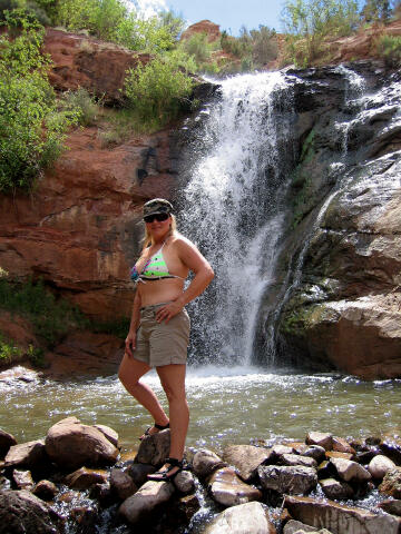
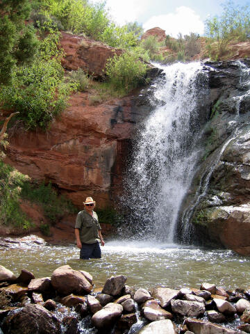
Faux
Falls is a very short hike to a beautiful desert waterfall. The route can be
enjoyed by any adult or child. No special gear is required. Most groups will want to bring
clothing suitable for swimming to maximize the fun. The swimming hole at the base of the
waterfall is approximately three to four feet deep. The waterfall is very photogenic.
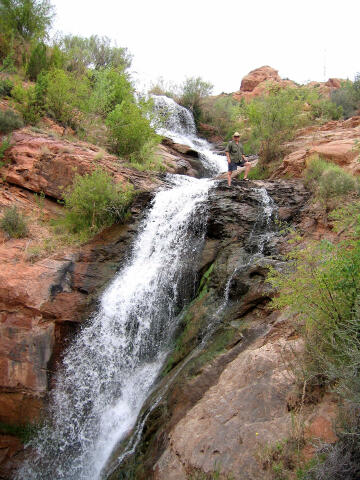
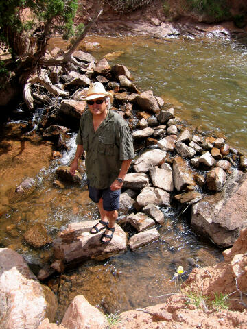
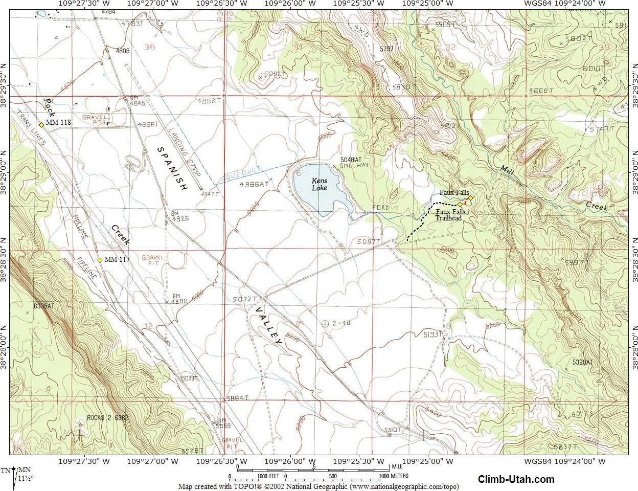
The hike involves walking approximately 200-yards each way. Total time required form trailhead to trailhead can range anywhere from 30 minutes to several hours. Faux Falls is rated 1C I using the Canyon Rating System. A GPS is extremely over-kill, but I've included the usual map and waypoints for the navigationally challenged. No map reading skills what-so-ever are required. The USGS 7.5' Map titled "Kane Springs" shows the area. All waypoints and maps for Mill Creek use the WGS84 datum.
From the center of Moab head south out of town on U.S. Highway 191 for approximately 7 1/2 miles to mile marker 117.9 (N38° 29' 13", W109° 27' 46"). Turn east (left) on the signed Kens Lake Road. Follow the road east for 0.5 miles to a tee. Turn south (right) on the LaSal Mountain Loop Road. Follow the road south for 0.6 miles to a fork (N38° 28' 45", W109° 26' 54"), take the east (left) fork. Follow the road east for 0.8 miles to the signed Kens Lake Road (N38° 28' 17", W109° 26' 12") on the east (left) side of the highway. Turn east on the Kens Lake Road and follow it for 0.5 miles to a junction (N38° 28' 36", W109° 25' 20"), The paved Kens Lake Road turns north (left), the Flat Pass Road turns to dirt and veers east (right). Follow the Flat Pass Road to the east. Follow the dirt road for 0.1 miles to an unsigned spur road (N38° 28' 36", W109° 25' 10") heading north (left). Follow the unsigned spur road for 0.5 miles to the Faux Falls Trailhead. The trailhead has parking for several vehicles and contains an information kiosk. The last 1/2 mile of dirt road before the trailhead can become rough at times and some might want to park and walk it. I have seen many passenger vehicles at the trailhead but I would not want to drive my shiny new Corvette to the actual trailhead. Rental cars should have no problem reaching this trailhead in normal weather conditions.
Route
Information: Camping:
Video:
© Copyright 2000-, Climb-Utah.com |