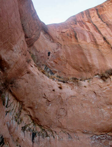
General Information: Navigation for this route is moderate. The route does traverse through some minor areas of cryptobiotic soil but they are easy to avoid with a little care. A GPS is useful. Good map reading skills and the USGS 7.5' Map titled "Moab" are essential. All waypoints and maps use the WGS84 datum. This canyon has an extremely small flash flood danger. In normal conditions this canyon does not require any swimming or wading. The route contains one mandatory rappel that is exactly 197-feet from anchor to ground. Make certain your rope is not short or you will be in big trouble. Additional gear should consist of several shoulder length slings, a couple double length slings, 50-feet of webbing, several rapid links, and a prusik system. This is a route where radio's are a big help because it's nearly impossible to communicate from the top of the big rappel to the bottom because of the echo's in the canyon. Normally I'm not a huge fan of gloves, but they are advised for the big rappel as I think they add a margin of safety. The anchors in this canyon are all bolted and easy to locate.
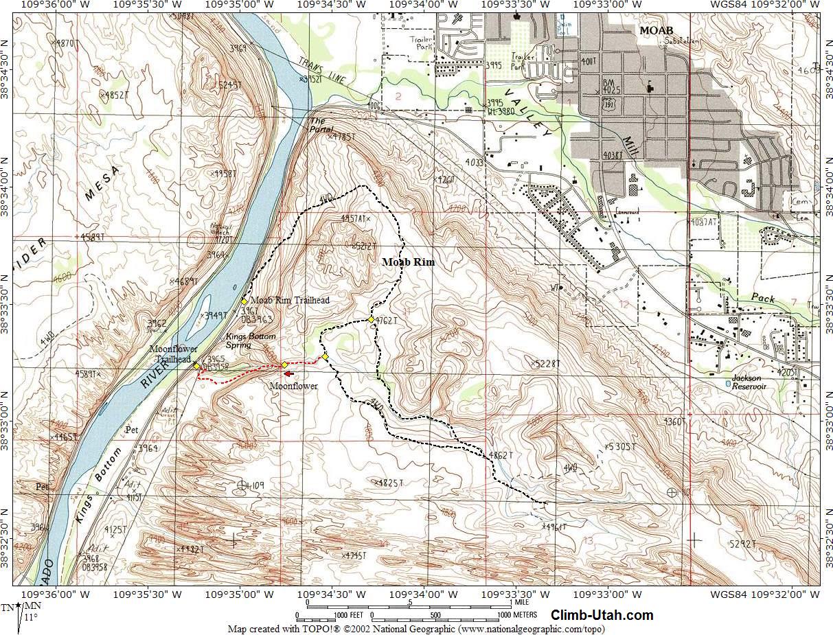
Moab Rim Trailhead: If you have a shuttle vehicle you can save yourself 1/2 mile of hiking by driving west on Kane Creek Drive for an additional 0.5 miles to the Moonflower Campground located on the east (left) side of the road. The trailhead is easily identified by a restroom and split rail fence. There is parking for a dozen vehicles. This is where you leave a shuttle vehicle if one is available.
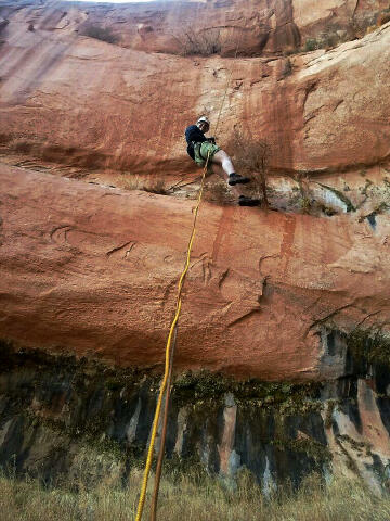
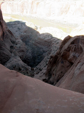
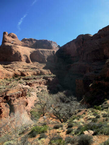
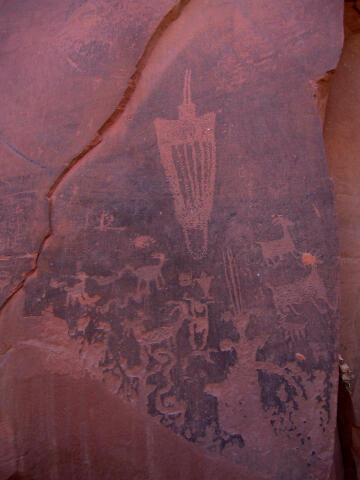
Route Information: Hike west down the Moonflower drainage and the sandstone walls will begin to rise. You will encounter a couple of potholes and pools that are easily bypassed. Soon you will reach a 10-foot drop into a large pool surrounded by willows. This drop can be downclimbed by the skilled or rappelled by a single bolt on the north (right) that allows you to miss the pool and keep from getting wet. Immediately past the 10-foot drop the bottom falls out of the earth and you are presented with a butt clinching 197-foot free hanging rappel (N38° 33' 15", W109° 34' 46"). Make certain your ropes are not short before you commit to this rappel. The rappel was anchored by two bolts on the north (right) canyon wall, but these were removed in May 2018. The rappel is currently anchored from a deadman in the bottom of a pothole that is often filled with putrid water. Make certain your webbing extends over the edge to avoid rope grooves in the sandstone and to create a good pull for your ropes. Make certain your ropes reach the canyon floor as a deadly accident in June 2018 was the result of short ropes. I also recommend you do not toss your rope from the top but instead let it just slide over the edge of the cliff. The reason for this is a tree is located right at the bottom of the rappel and if you throw your ropes out over the edge they have a habit of becoming tangled in the top of the tree. If you just let your rope slide over the edge of the drop this should not be an issue. Please be aware of poison ivy are the base of the rappel. From the bottom of the rappel walk down the west (left) rim of the canyon until you are under the power lines. From there you can easily route find your way east to the bottom of Moonflower Canyon. There is an emerging social trail that zig-zags down the side of the cliff and deposits you in the middle of the Moonflower Campground (N38° 33' 14", W109° 35' 14"). The trail down requires only minor scrambling. If you encounter exposure your route-finding skills need improvement and you should look for a better way down. Once at the Moonflower Campground you might want to spend a minute and check out the Moonflower petroglyphs and log climb. From the Moonflower Campground, it is a 1/2 mile hike east on Kane Creek Road to where you began the day.
© Copyright 2000-, Climb-Utah.com |