[ Homepage
] [ Introduction ] [ Warning ] [ Ratings
] [ Ethics ] [ Feedback ] [ Updates
]
 |
Potash Petroglyphs
& Dinosaur Tracks
Moab Area
Roadside Attraction
Potash
Road just outside of Moab has many wonderful roadside attractions. Some of the best
attractions are two large panels of petroglyphs and several dinosaur tracks. This is an
adventure everyone can enjoy. |
General Information:
 The Potash Road Petroglyphs are not
a hike but a road side attraction. The rock art can be viewed from your car, which makes
this adventure accessible to everyone. The Potash Dinosaur tracks require a 200-yard
stroll across a rocky hill side.Total time required for this adventure starting in Moab is
1 to 2 hours. There are no fences or guard rails at these sites. You are the protector of
this environment.
The Potash Road Petroglyphs are not
a hike but a road side attraction. The rock art can be viewed from your car, which makes
this adventure accessible to everyone. The Potash Dinosaur tracks require a 200-yard
stroll across a rocky hill side.Total time required for this adventure starting in Moab is
1 to 2 hours. There are no fences or guard rails at these sites. You are the protector of
this environment.
Navigation
for this adventure is easy. The attractions are well marked. A GPS is a waste of time, but
I have included the important waypoints for the gadget heads. The USGS 7.5' Map titled
"Moab" covers these attractions. You should have no problems completing this
adventure using only common sense.
There are
several nice BLM campgrounds on Potash Road along the Colorado River. For more information
or for reservations, please call the Bureau of Land Management Moab Field Office at (435)
259-2100.
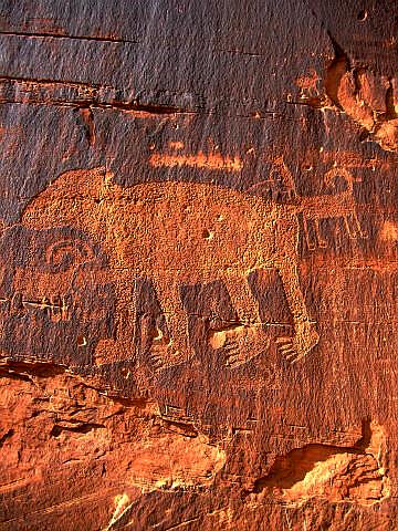
Petroglyph Information:
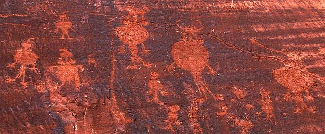
Archaeologists believe that
most the petroglyphs were done by Indians of the Southern San Rafael Fremont culture,
which flourished between 600 A.D. and 1300 A.D. The Fremont art includes older portrayals
of animals, lines of hand-holding men and triangular figures with horns, spears and
shields.
The more modern petroglyphs,
including the horsemen and many of the hunting motifs appear to be the work of Ute Indians
in relatively recent times. They show less weathering and less attention to detail than
the Fremont rock art.
These petroglyphs are fragile and
easily marred. Please help preserve them for the enjoyment of others.
Driving Information:
From
Moab head north out of town on U.S. Highway 191. Cross the bridge over the Colorado River.
After crossing the bridge continue north for 1.3 miles to the signed "Potash"
road, which is State Road 279. Turn west (left) and follow State Road 279 for 5.1 miles to
a pull-out signed Indian Writing (N38° 32' 32", W109° 36' 02"). The pull-out
is on the south side of the road next to the river. Please be careful crossing the road to
view the petroglyphs. And additional 0.1 miles west on Potash Road is a second pull-out
with more petroglyphs.
To locate
the dinosaur tracks you must continue driving west for 0.7 miles beyond the second Indian
Writing pull-out (6.0 miles total along Potash Road). Turn into the signed Poison Spider
Trailhead. The trailhead is marked by a large gravel parking lot, information kiosk and
pit toilet.
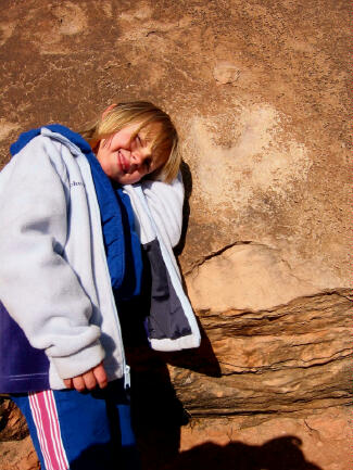
Dinosaur Track
Information:
From the
Poison Spider Trailhead (N38° 31' 58", W109° 36' 31"),
locate the signed trail to the dinosaur tracks that begins next to the pit
toilet. Follow the trail east for 200-yards as it zig-zags up the
ledges to the flat rock with the most visible dinosaur tracks (N38° 32' 01",
W109° 36' 28"). If you look around you will notice that several similar
rocks in the area also contain dinosaur tracks.
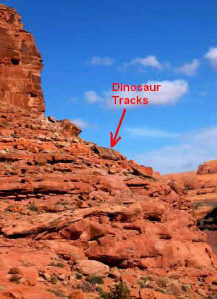
From the dinosaur tracks follow the trail north as it climbs to the base of the cliff
where you will locate several really nice panels of petroglyphs (N38° 32'
02", W109° 36' 30"). At the west end of the petroglyph panels you will find
a second large boulder with dinosaur tracks.
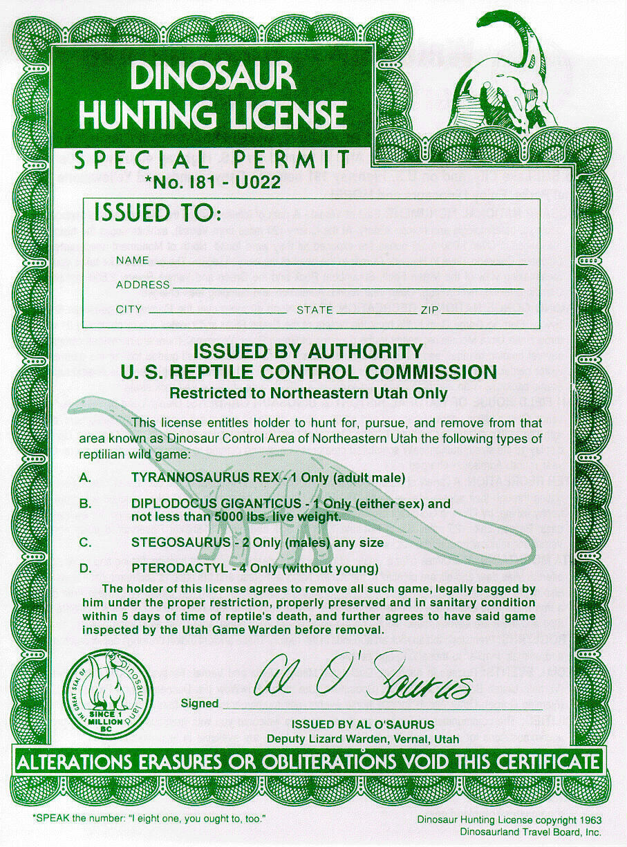
Dinosaur Hunting
License:
Because you are good parents and I would hate to see your children out hunting dinosaurs
illegally I have provided you with a method to download your dinosaur hunting license. Please download and fill
out the license and carry it with you at all times while hunting dinosaurs.
[ Homepage
] [ Introduction ] [ Warning ] [ Ratings
] [ Ethics ] [ Feedback ] [ Updates
]
© Copyright
2000-, Climb-Utah.com |
