General Information: In normal conditions this canyon does not require any swimming or wading. The route contains several rappels with the longest being 120-feet. Additional gear should consist of several shoulder length slings, a couple double length slings, 50-feet of webbing, several rapid links, and a prusik system. Navigation for this route is moderate. The route does traverse through some minor areas of cryptobiotic soil but they are easy to avoid with a little care. A GPS is useful. Good map reading skills and the USGS 7.5' Map titled "Moab" are essential. All waypoints and maps use the WGS84 datum. This canyon has an extremely small flash flood danger.
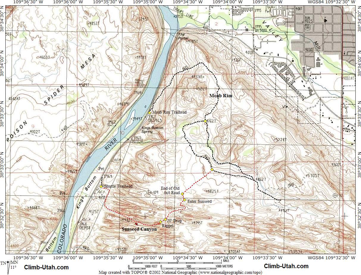
Moab Rim Trailhead: If you have a shuttle vehicle you can save yourself 1 mile of hiking by driving west on Kane Creek Drive for an additional 1.0 miles to a gravel spur road (N38° 32' 53", W109° 35' 35"), which climbs south from the east (left) side of Kane Creek Drive. Follow the spur road 200-yards to the top of the cut. This is the Shuttle Trailhead. This is also the trailhead for the Mastodon Route and Upper Cut Route. The trailhead is identified by a private residence located 50-yards south of the trailhead. What appears to be a large parking lot is actually half public and half private, stay as far away from the private residence as possible and you will be on public land. Please be considerate of the residence privacy when visiting so we don't lose this access. There is parking for several vehicles at the trailhead..
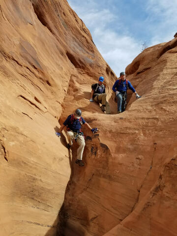
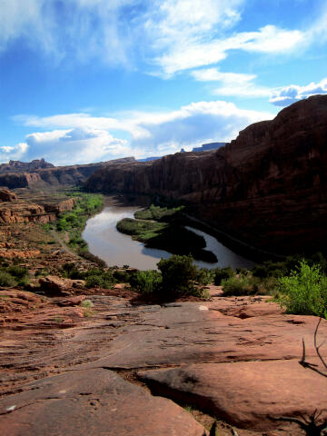
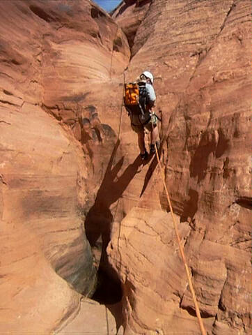
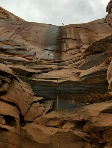
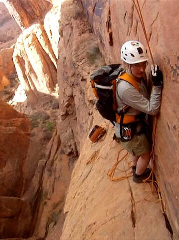
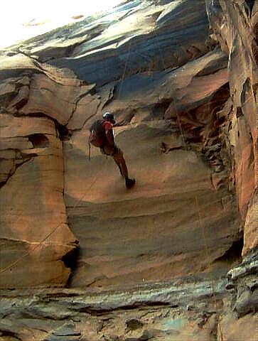
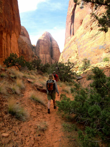
Route Information: From the end of the closed 4x4 road hike south-southeast for 250-yards to the start of Sunseed Canyon (N38° 32' 39", W109° 34' 33"). Once in the bottom of the drainage just follow it downstream bypassing minor obstacles as they present themselves. Soon you will encounter a 30-foot wall that can be rappelled using a small tree as your anchor, or simply downclimb using a ledge system to the west (right). Keep hiking downstream and soon you will reach a 20-foot drop (N38° 32' 28", W109° 34' 47") that can be downclimbed, handlined or rappelled. The downclimb is not as hard as it looks, but if you want to rappel the drop you will need to establish an anchor. Using your best climber as an anchor and than spotting him from below as he downclimbs is a popular option for defeating this obstacle. From the bottom of the 20-foot drop you will be presented with what appears to be a huge drop (N38° 32' 27", W109° 34' 51"). The good part about this huge drop is it can be broken into two-stages. The upper stage is 120-feet down to a ledge and is anchored by two bolts on the south (left) canyon wall. The bottom portion of the upper rappel is free-hanging. The bad part about this rappel is you must extend the rappel anchor over the edge or you will not be able to retrieve your ropes from below. This makes the start of the rappel a little scary. The best option is to anchor the ropes up high near the bolts for everyone in the group to create and easy start to the rappel. The last person down can extend the webbing over the edge and be protected from a fall by the group below using a fireman's belay. If you do not take the time to properly anchor this rappel and create a smooth rope pull you might find yourself stranded on the mid-point ledge. The mid-point ledge is an interesting place. The ledge is large enough to comfortably fit a party of 6 or more, but the ledge is exposed. The ledge is about 3-feet wide and 20-feet long and the upper rappel deposits you right in the middle of it. Pictures of this ledge make it look a lot scarier than it actually is, there is plenty of room to work with. The second stage of this rappel is much easier. The second stage is 100-feet and is anchored by two bolts at the south (left) end of the ledge. the bolts are located next to a small tree and create a straightforward rappel down to the canyon floor. Once on the canyon floor simply hike down the stunning canyon. As you exit the canyon you will encounter some overhead power lines. Follow the power lines north (right) until you stumble upon the power line maintenance road. Scramble down to the maintenance road and the optional shuttle trailhead (N38° 32' 47", W109° 35' 35"). Do not continue hiking west beyond the power lines trying to reach Kane Creek Road as you will be on private property and trespassing. If you have a shuttle vehicle your route is finished, if not you must still hike north (right) for 1 mile on Kane Creek Road.
© Copyright 2000-, Climb-Utah.com |