[ Homepage
] [ Introduction ] [ Warning ] [ Ratings
] [ Ethics ] [ Feedback ] [ Updates
]
 |
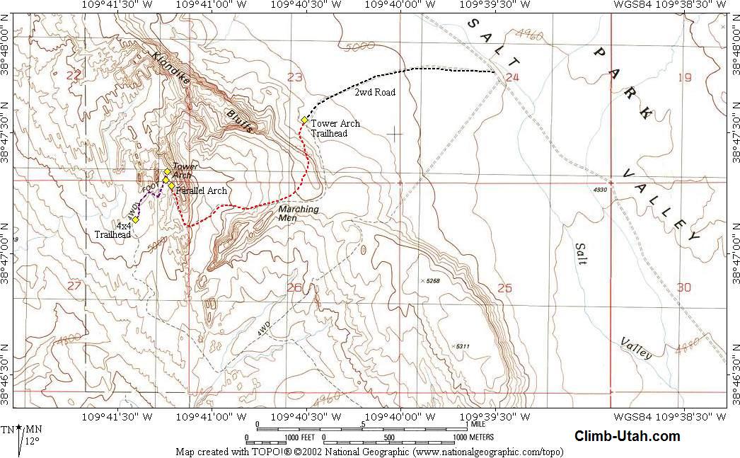
Tower Arch
Arches National Park
Hiking
Tower
Arch is located in the remote Klondike Bluffs section of Arches National Park. The arch
has an interesting history and is often visited by those spending several days in the
park. While not totally secluded this route usually enjoys diminutive crowds. This route
follows a well defined trail and is a good choice for novice hikers who want to visit a
more remote section of Arches National Park. |
General Information:
  Tower Arch is a wonderful desert
hike that will require 2 to 3 hours round trip. The route is 1 1/2 miles each way across
open desert. Elevation gain on this hike is minor. This route should be easy for most
healthy hikers. Tower Arch requires you carry a
least enough water for half-a-day in the desert, depending on current conditions.
Tower Arch is a wonderful desert
hike that will require 2 to 3 hours round trip. The route is 1 1/2 miles each way across
open desert. Elevation gain on this hike is minor. This route should be easy for most
healthy hikers. Tower Arch requires you carry a
least enough water for half-a-day in the desert, depending on current conditions.
Navigation for this route
is easy. There trail is well marked and often traveled. Mistakes in navigation are easy to
overcome and correct on this route. A GPS is extreme overkill. Good map reading skills and
the USGS 7.5' Map titled "Klondike Bluffs" are helpful. All waypoints and maps
for this route use the WGS84 datum. This route is rated class 1 I using the Yosemite
Decimal System.
Follow the route
described and you will avoid areas of cryptobiotic crust along this route. Please avoid
disturbing all cryptobiotic crust. Stay on existing trails, walk in wash bottoms or on
slickrock. Go out of your way, literally, to avoid cryptobiotic soil. Cryptobiotic crust
requires five to ten years of undisturbed growth before it even becomes visible as an
irregular, blackish mat on the soil surface. A single footprint by a careless hiker can
destroy decades of growth!
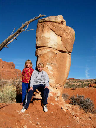
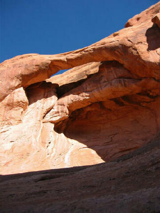
Tower Arch Facts:
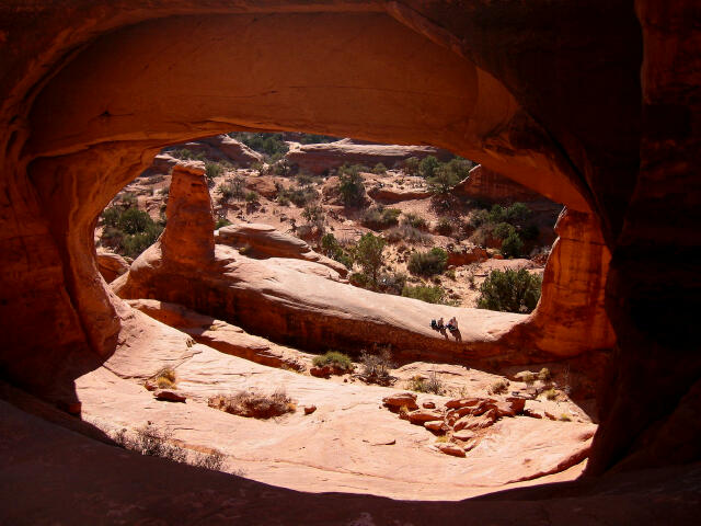
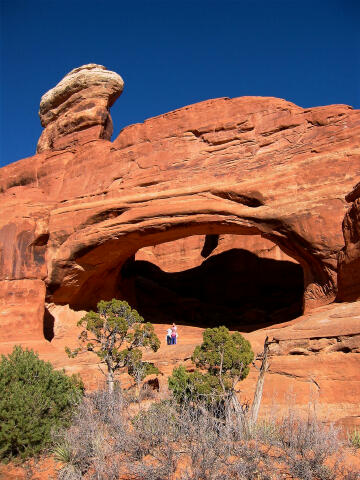
Tower Arch is an old fin
type natural arch, weathered into the Entrada sandstone. It has a span of 92 feet, a
height of 43 feet, a thickness of 50 feet, and a width of 29 feet.
Tower Arch History:
What fun is a monster arch
without a bit of controversy? Those who look closely will find two inscriptions, one each
on the north and south abutments of the arch.
The inscription on the
south abutment reads "DISCOV'D BY M. AND MRS. ALEX RINGHOEFFER AND SONS
1922-23." the inscription has led to much controversy because the name
"Ringhoffer" is misspelled and the date 1922-23 is cryptic. The Ringhoffer
family operated a silver mine in Salt Valley and spent Sundays exploring the surrounding
country. The family was probably aware of the arch. It is unknown who actually carved the
inscription.
The second inscription
reads "Minaret Bridge, H.S. Bell 1927." In 1933 and 1934 the Arches National
Monument Scientific Expedition conducted an in-depth reconnaissance of the new monument.
The expedition was led by Frank Beckwith, a local newspaper editor and amateur scientist,
who was responsible for naming many of the arches. Including the naming of Tower Arch. It
appears that Beckwith was unaware or disregarded the name Minaret Bridge.
Trailhead Information:
Follow the main road into Arches National Park and do not turn-off until told to do so.
From Arches National Park Visitor Center drive into the park for 16.3 to the signed dirt
road on the south (left) side of the road. Turn south on the dirt road, pass through a
gate that is locked during bad weather, and follow the dirt road for 7.0 miles to a signed
junction. The spur road to the west (left) offers 4x4 access to Klondike Bulls. Continue
north (straight ahead) on the main dirt road for an additional 50 yards to a second signed
spur road heading west (left). Follow the second spur road for 1.0 miles to the Tower Arch
trailhead.
The Tower Arch Trailhead is identified by parking for several vehicles, information kiosk
and a a pit toilet. The trailhead is accessible to all vehicles in good weather. The dirt
road become impassable during inclement weather.
Route
Information:
The entire route is
easy to follow if to watch for cairns (small stacks of rocks) used to mark the route. From
the Tower Arch Trailhead (N38° 47' 33", W109° 40' 31") follow the trail west.
The route immediately climbs a short but steep ridge that might require some minor
scrambling. From the top of the ridge you will be presented with an outstanding view of
the area. From the ridge the trail crosses a long rocky area that requires hiking from
cairn to cairn and descends slightly to the bottom of a minor drainage. The route crosses
the drainage and climbs a short but steep sand hill before turning north into a passage
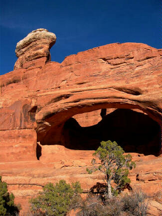
that snakes through the rocks. Along this section you will pass next to Parallel Arch
(N38° 47' 17", W109° 41' 13") on your right (east) side. 75 yards past
Parallel Arch you will encounter a trail junction (N38° 47' 19", W109° 41'
15"). The trail to the west leads to the optional 4x4 Trailhead. At this point you
should be presented with a fantastic view of Tower Arch (N38° 47' 20", W109° 41'
14"). Continue following the main trail 100 yards east, as it climbs beneath the
massive arch. The more adventurous will find the surrounding area interesting to explore.
Optional 4x4
Trailhead:
Those with a 4x4 can
drive the optional 4x4 route that swings wide to the south before approaching Tower Arch.
The 4x4 Trailhead (N38° 47' 08", W109° 41' 25") offers a view of the arch from
a distance. Those who wish to actually visit the arch must follow the hiking trail east
for 1/4 mile.
[ Homepage
] [ Introduction ] [ Warning ] [ Ratings
] [ Ethics ] [ Feedback ] [ Updates
]
© Copyright
2000-, Climb-Utah.com |