[ Homepage ] [ Introduction ] [ Warning ] [ Ratings
] [ Ethics ] [ Feedback ] [ Updates
]
 |
Yellow Cat Mines
Poison Strip
Moab
Historic Mining Relics
Uranium deposits around the Moab area first attracted
miners in the 1890's, but none of the mines paid off until the Atomic
Energy Commission increased demand during the Cold War in the 1950's.
Soon fortune hunters came in large numbers, and there were many
profitable mines located around Yellow Cat Flat and The Poison Strip.
The area had a large collection of miners, prospectors and profiteers.
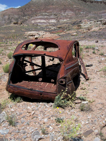
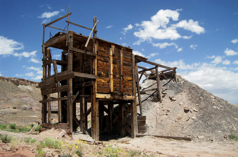
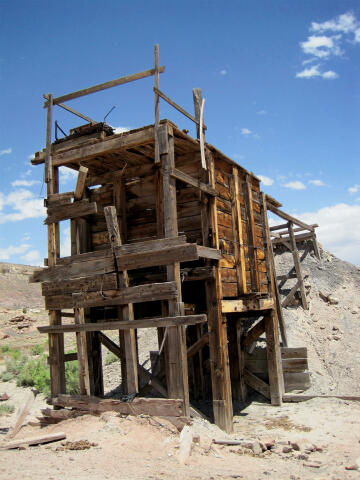
There are numerous audits tunneled into the hillsides. These mines were
often abandoned as fast as they sprang up leaving workings, ore hoppers,
cabins, vehicles and equipment to rot and rust.
The Poison Strip gained
its name because of the arsenic in the soil, which killed the sheep that
grazed the area.
|
General Information:
 The mining relics can be visited in a few minutes or several hours,
depending on how much exploring and searching you want to do. There are many
open mines in the area. It is dangerous to enter audits or tunnels, because
of the buildup of deadly radon gas.
The mining relics can be visited in a few minutes or several hours,
depending on how much exploring and searching you want to do. There are many
open mines in the area. It is dangerous to enter audits or tunnels, because
of the buildup of deadly radon gas.
Navigation
for visiting the area is easy. A GPS is useful in locating the ruins. The USGS 7.5' Map titled "Mollie
Hogans" and good map reading skills are essential. All waypoints and maps
use the WGS84 datum.
Driving Information:
The road is normally suitable for high clearance vehicles and
carefully driven passenger cars in dry weather conditions. The area is
criss-crossed with roads. Stay on the road described until told to turn off
of it.
From Green River, Utah: Travel east for 18 miles to Crescent Junction
(where I-70 meets Highway 191).
From Moab, Utah: Travel north on Highway 191 for 30 miles to Crescent
Junction (where I-70 meets Highway 191).
From Crescent Junction: Follow I-70 east for 11 miles to Exit 193
(N38° 56' 32", W109° 36' 53"), signed Yellow Cat. Exit I-70 and turn south.
Follow the graded Yellow Cat Road southeast for 6.2 miles to a fork (N38°
52' 04", W109° 33' 00"). Take the east (left) fork. Continue following the
road for 2.1 miles to the Yellow Cat Mine Ruins (N38° 50' 53", W109° 31'
42"). The ruins are located on the east side of the road.
Area Information:
From the large
ore hopper a maze of tracks lead to the south (right) to the remains of the
Parco Mines and Little Eva Mines. These are all private property and posted
as Lucky Strike, but they do not appear to be actively worked. Visiting
these mines allows you to see many old ruins, workings, audits and equipment
left abandoned. Holes, audits, shafts and diggings
are usually unmarked so caution needs to be exercised when exploring the
area.
[ Homepage
] [ Introduction ] [ Warning ] [ Ratings ] [ Ethics
] [ Feedback ] [ Updates ]
© Copyright
2000-, Climb-Utah.com |