 The Ruth Lake hike is an
adventure the entire family can enjoy. The scenic route visits the beautiful Ruth Lake.
The Ruth Lake area offers a great introduction into overnight backpacking and is a very
child friendly region.
The Ruth Lake hike is an
adventure the entire family can enjoy. The scenic route visits the beautiful Ruth Lake.
The Ruth Lake area offers a great introduction into overnight backpacking and is a very
child friendly region.
The basic round trip hike to Ruth Lake can be completed in less than 1 hour. It would be easy to spend an entire day in the area exploring all of the concealed lakes in the area. A vehicle shuttle is not required, this is an out and back hike. All hikers in your party should carry a minimum of one liter of water. Water is plentiful in this area, but all water taken from lakes and streams should be filtered before drinking. The route contains no real obstacles. Novice hikes will have no problems with this route. Experienced and intermediate hikers can easily entertain themselves with several cross-country hikes to secluded lakes in the immediate area. The Ruth Lake Route is rated 1 I using the Yosemite Decimal System. Afternoon thunderstorms are very common in the high Uinta Mountains so go prepared with rain gear. Because of the high precipitation mosquito's are common in the Uinta's. A mosquito repellent that contains DEET (N,N-diethyl-m-toluamide) is most recommended. Navigation for this route is easy. A GPS is useful in identifying waypoints if you intend to travel cross-country to any of the secluded lakes. Good map reading skills and the USGS 7.5' Maps titled "Mirror Lake" and "Hayden Peak" are helpful. All waypoints and maps for this route use the WGS84 datum. Use
Fee: Fishing:
Trailhead
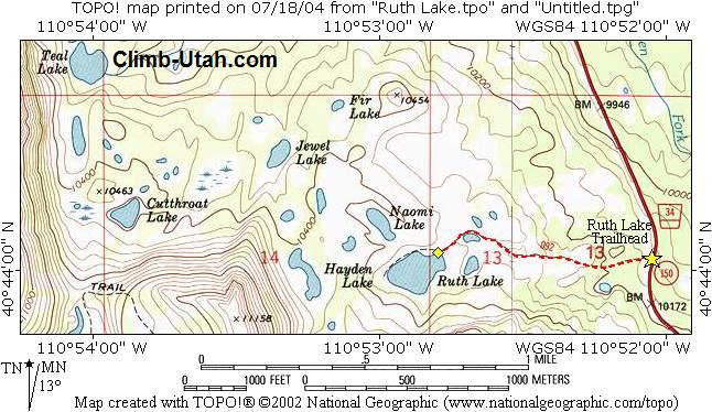
Information: From Evanston, Wyoming follow Highway 150 south for 43 miles to the signed Ruth Lake Trailhead located at mile marker 35.0. The large parking area at Ruth Lake Trailhead is paved and located on both sides of Highway 150. The trailhead contains an information kiosk and a pit toilet. Improved campgrounds are located nearby at Butterfly Lake and Mirror Lake. Any vehicle can access this trailhead.
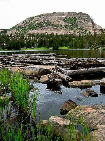
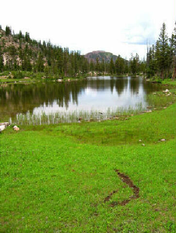
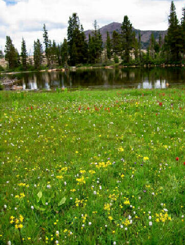
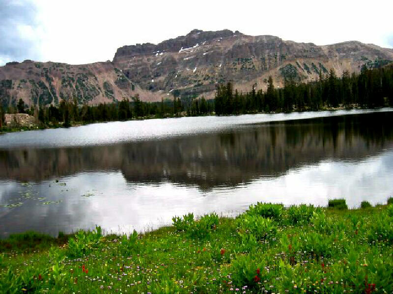
From the Ruth Lake Trailhead (N40° 44' 02", W110° 52' 03") follow the well-maintained trail west for 3/4 mile to Ruth Lake (N40° 44' 03", W110° 52' 48"). The trail is easy to hike and very scenic as it passes near a meadow. Hayden Peak provides a massive and astonishing backdrop to the east. Experienced Hiker
Options: Backpacking to Ruth Lake would be a waste of time because of the short distance and high visitation. But backpacking to several of the secluded lakes would be a simple and rewarding experience. Video:
© Copyright 2000-, Climb-Utah.com |