[
Homepage ] [
Introduction ] [
Warning ] [
Ratings
] [ Ethics ] [
Feedback ] [
Updates ]
 |
Mount Grandeur
Elevation 8299'
Wasatch Mountains
Hiking & Mountaineering
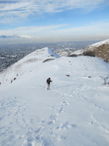
Grandeur Peak is the most easily accessible of the major peaks that form
the Salt Lake City skyline. For many valley residents Grandeur Peak was
their first major summit. The peak offers great views of the valley and
year round access to hikers of all abilities. |
General Information:
  The summit of Grandeur Peak is 8299'. The peak is normally climbed year
round by hikers of all abilities. The summit is accessible by two different
routes. The easiest and most popular trail is Church Fork, which is accessed
from Millcreek Canyon. The second and slightly more challenging route is the
West Ridge, which is accessed form Wasatch Boulevard. It is also possible to
traverse Grandeur Peak with a car or bicycle shuttle. If you attempt a
traverse, the preferred direction is to climb the West Ridge and descend
Church Fork.
The summit of Grandeur Peak is 8299'. The peak is normally climbed year
round by hikers of all abilities. The summit is accessible by two different
routes. The easiest and most popular trail is Church Fork, which is accessed
from Millcreek Canyon. The second and slightly more challenging route is the
West Ridge, which is accessed form Wasatch Boulevard. It is also possible to
traverse Grandeur Peak with a car or bicycle shuttle. If you attempt a
traverse, the preferred direction is to climb the West Ridge and descend
Church Fork.
Both summit routes have
their own personal advantages and charms. The Church Fork route is 3 miles
long, follows a well-maintained trail, begins 900' higher, and is pleasant
to hike in the evening on hot days. Church Fork is by far the more popular
of the two options.
The West Ridge route is 2 1/4 miles long, a little more
challenging, and offers amazing views of the Salt Lake Valley the entire
climb. The West Ridge Route follows a maintained trail for the first part of
the hike and a steep well traveled use trail for the second part of the
route. This route is enjoyable to climb in the mornings on hot days. The
West Ridge trail is not nearly as heavily traveled as Church Fork.
Both routes will require approximately 2 1/2 hours from
trailhead to summit. Both routes are rated 2 III using the Yosemite Decimal System (YDS). The
summit is often climbed year round by experienced hikers and mountaineers.
Beginners will find summer and fall to be the preferred months to climb this
mountain.
A GPS might be helpful, but is not required for either route. The USGS 7.5'
Maps titled "Sugar House" and "Mount Aire" show the area described. All waypoints and maps for Mount
Grandeur use the WGS84
datum.
It is not uncommon to see rattlesnakes on this trail. During
the spring and fall, rattlesnakes tend to be out during the daytime when the
sun is out. During the heat of summer, rattlesnakes hang out in the mornings
and evenings when it is cooler. Rattlesnakes are never and issue and are
easy to avoid if you are cautious and watch for them. Rattlesnakes are a
major incentive for not wearing headphones when hiking.
 |
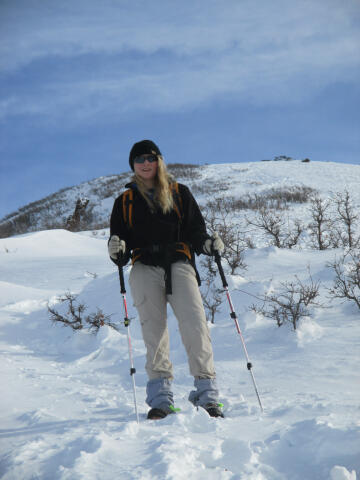 |
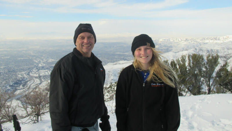
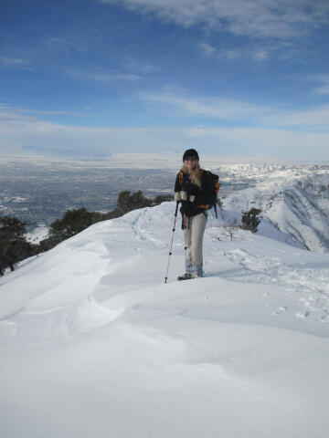
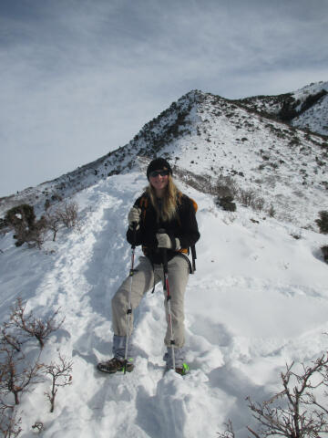
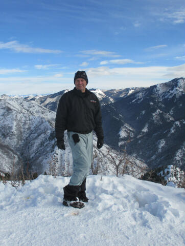
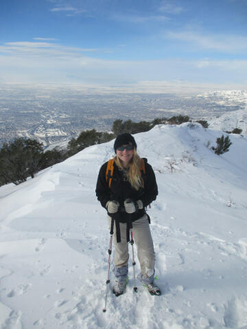
Winter Climbing:
The 8299' summit of
Mount Grandeur is climbed year round by experienced hikers and
mountaineers. If you attempt this
summit in winter I suggest you bring good waterproof boots, gaiters and ski
or trekking poles. In late winter and early spring the snow will be
approximately 10 to 15 feet deep on the summit. I have never required
snowshoes to summit since the trail is usually well traveled and packed. If
you want to snowshoe I suggest the Church Fork Route as the West Ridge is
very steep in places. Avalanche
danger is minimal using the West Ridge route, while the Church Fork route
depends on other factors and precautions should be taken. You have been warned!
 |
 |
Church Fork
Trailhead:
The
Church Fork Trailhead is located up Millcreek Canyon east of Salt Lake City.
From Wasatch Boulevard and 3800 South, Follow 3800
South east for 0.7 miles to the Millcreek Fee Station. A small fee is
charged to enter Millcreek Canyon ($3.00 per vehicle in 2016). From the Fee
Station continue following the road east up Millcreek Canyon for 2.3 miles
to the signed Church Fork Picnic Area located on the north (left) side of the road.
I always park on the main road. In winter the picnic area is closed which
leaves you no option. In summer there is a small parking lot at the top of
the picnic area, which is always full and never has an empty spot. The picnic area gate is locked at
10:00 p.m. so park on the main road if you will not be down before than. If you
are hiking the trail, please do not take up a picnic site for parking.
West Ridge Trailhead:
The
West Ridge Trailhead is located east of Salt Lake City on Wasatch Boulevard.
From the stop light at 3300 South and Wasatch Boulevard head
east to stay on Wasatch Boulevard. Wasatch Boulevard immediately turns north
and parallels I-215. Follow Wasatch Boulevard for 0.5 miles to where it ends
at the West Ridge Trailhead. The trailhead consists of paved
parking along with an information kiosk.
The parking lot is gated and closed at 10:00 p.m. so plan
accordingly.
 |
 |
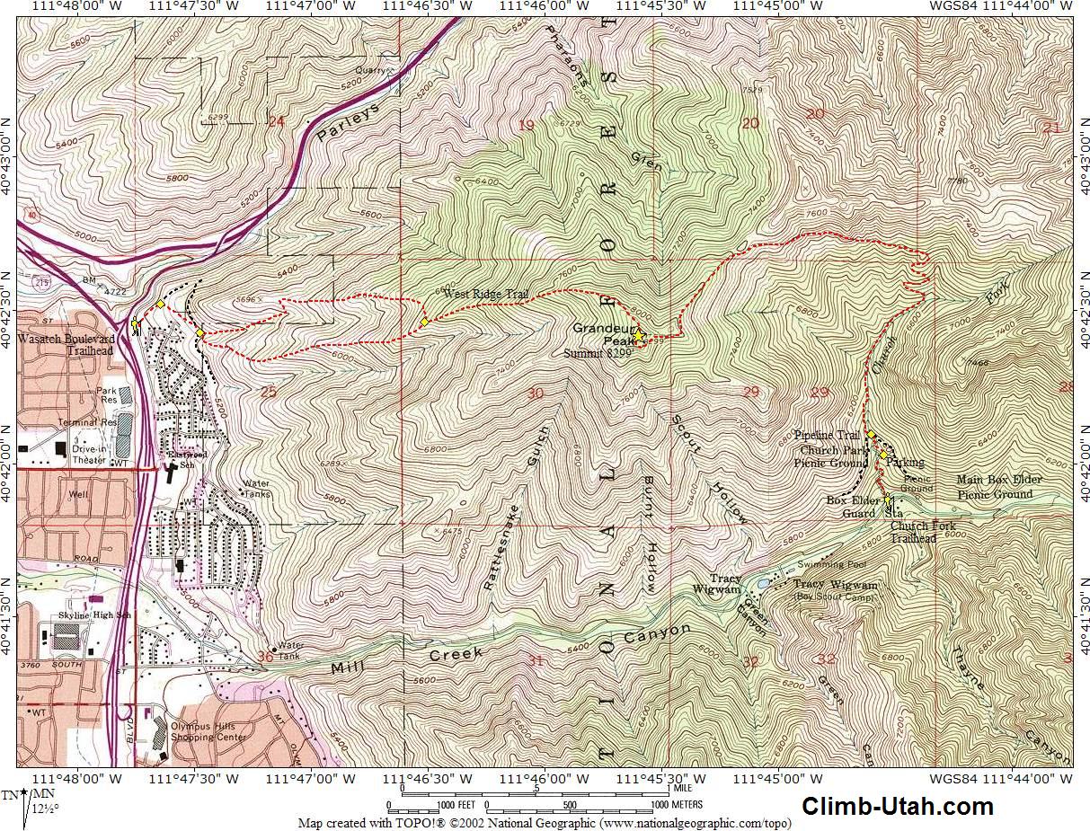
Church Fork Route:
From Millcreek Canyon Road (N40° 41' 52", W111° 44'
32") follow the paved road north through the picnic
area for 1/4 mile to the small upper parking area (N40° 42'
02", W111° 44' 33"). Beginning at the parking area
there is a well-maintained trail which is signed and easy to follow. Follow
the trail north for 200-yards to where the Church Fork Trail crosses the
Pipeline Trail (N40° 42' 06", W111° 44' 36").
You want to keep following the Church Fork Trail, which is the trail that
heads north and follows the stream. From here it is 2 3/4 miles to the
summit. The trail will soon reach some switchbacks that climb to a saddle
with an outstanding view into Parleys Canyon and the Salt Lake Valley. From
the saddle continue following the trail to Grandeur Peak (N40°
42' 25", W111° 45' 36").
West Ridge Route:
From the West Ridge Trailhead (N40° 42' 27", W111°
47' 45"), hike northeast for 200-yards up the trail
to a fork (N40° 42' 31", W111° 47' 39").
Take the fork to the south (right) and follow the trail an additional
250-yards to a gully (N40° 42' 26", W111° 47' 29")
entering from the east (left). The gully is formed by the first and second
ridge south of Parleys Canyon.
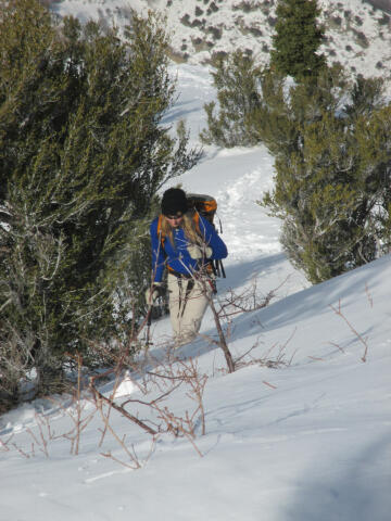
At this point you have two choices and both are equally as good. You can
follow a trail to the south (right) which immediately climbs to the top of a
ridge and follows it up. Or you can follow a well-maintained trail leading
up the bottom of the gully. The trail follows the gully and than cuts north
(left) to the ridge top and a view of Parleys Canyon. From the Parleys
Canyon viewpoint the route is a well-used hiker trail that follows the ridge
up.
It really doesn't matter which trail you choose as they rejoin 1 mile above
at a junction (N40° 42' 28", W111° 46' 31").
From the junction of the two trails just keep following the well traveled
trail for 1 mile up the steep ridge to Grandeur Peak (N40° 42'
25", W111° 45' 36").
Video:
Enjoy a short video
of a hike to the south summit of 8299' Mount Grandeur.
Grandeur Peak - Church Fork
Length: 3 miles - One Way.
Time: 2 1/2 hours - One Way.
Trailhead: 5,900'
Summit: 8,299'
Skill Rating: Easy, there is nothing difficult.
Season: Year Round.
Equipment: Ski poles & Gaiters in winter.
Water: 2 liters per person.
Difficulties: None. Navigation is extremely easy. |
Grandeur Peak - West
Ridge
Length: 2 1/4 miles - One Way.
Time: 2 1/2 hours - One Way.
Trailhead: 5,000'
Summit: 8,299'
Skill Rating: Easy
Season: Year Round.
Equipment: Ski poles & Gaiters in winter.
Water: 2 liters per person.
Difficulties: Minor Navigation. |
[
Homepage
] [ Introduction ] [
Warning ] [
Ratings ] [
Ethics
] [ Feedback ] [
Updates ]
© Copyright
2000-, Climb-Utah.com |