[ Homepage ] [ Introduction ] [ Warning ] [ Ratings ] [ Ethics ] [ Feedback ] [ Updates ]
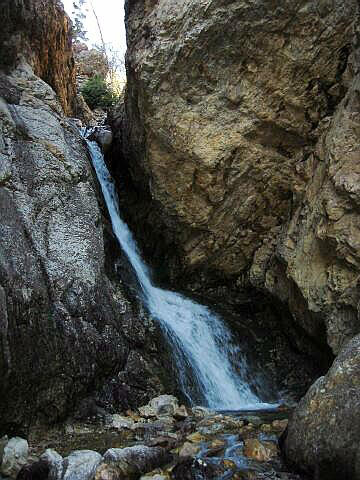
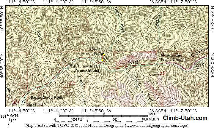
General Information: The route contains no obstacles and is suitable for anyone capable of walking. Navigation for this route is easy. A GPS is useful is a complete waste of time but for those who must know the USGS 7.5' Map titled "Mount Aire" is where you will find the waterfall. All waypoints and maps for this route use the WGS84 datum. Big Cottonwood Canyon is within Salt Lake City Watershed, therefore special restrictions apply and are strictly enforced. No domestic animals (dogs, cats, horses) are permitted in Big Cottonwood Canyon. Trailhead Information:From anywhere in the Salt lake Valley take I-215 East until you reach the 6200 South Exit (Exit 6). Signs are marked for the ski areas, you will be heading towards Brighton and Solitude Ski Resorts. Drive east on 6200 south and the road will become Wasatch Boulevard. Follow Wasatch Boulevard south to an intersection with Fort Union Boulevard (7200 South). The intersection is located 1.7 miles after exiting I-215. All mileage is taken from the intersection of Wasatch Boulevard and Fort Union Boulevard. This is known locally as the "Mouth of Big Cottonwood Canyon". There is a large Park and Ride lot with restrooms located near the north east corner of the intersection. From the intersection drive east up Big Cottonwood Canyon. After 4.4 miles you will reach the signed "Mill B Trailhead", which is located at what is locally known as the "Bottom of the S-Curve". There are two parking lots. The first is located to the south of the lower bend in the S-Curve. (the trailhead begins at the top of the S-Curve). The second is located to the east inside the upper bend of the S-Curve. The Mill B Trailhead is the beginning of several popular hikes and fills up early on weekends during periods of good weather. Route
Information: [ Homepage ] [ Introduction ] [ Warning ] [ Ratings ] [ Ethics ] [ Feedback ] [ Updates ] © Copyright 2000-, Climb-Utah.com |