[
Homepage ] [
Introduction ] [
Warning ] [
Ratings
] [ Ethics ] [
Feedback ] [
Updates ]
 |
Mount Olympus
Elevation 9026'
Wasatch Mountains
Hiking & Mountaineering
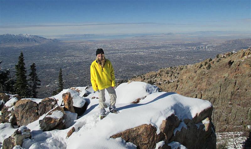
Mount Olympus dominates the Salt Lake City skyline and is one of the
most popular hikes in the valley. The spectacular summit view is
extremely rewarding. |
General Information:
  The 7 mile round trip summit hike into the Mount Olympus Wilderness Area
will require approximately 7 hours. The route is
rated 2 III using the Yosemite Decimal System (YDS). The
summit is often hiked year round by experienced hikers and mountaineers.
Beginners will find summer and fall to be the preferred months to climb this
mountain.
The 7 mile round trip summit hike into the Mount Olympus Wilderness Area
will require approximately 7 hours. The route is
rated 2 III using the Yosemite Decimal System (YDS). The
summit is often hiked year round by experienced hikers and mountaineers.
Beginners will find summer and fall to be the preferred months to climb this
mountain.
A GPS might be helpful, but is not required for this route. The USGS 7.5'
Map titled "Sugar House" shows the area described. Navigation for this route
is moderate. Mount Olympus follows a trail all the way to the summit. The
final 1/4 mile scramble to the summit can be a little difficult to navigate
for beginning hikers not paying attention, all others should have no
problem. All waypoints and maps for the Mount Olympus hike use the WGS84
datum.
 |
 |
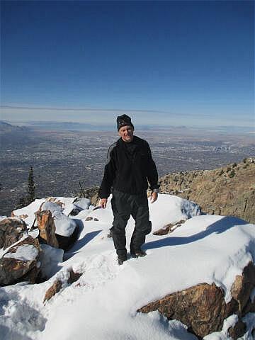
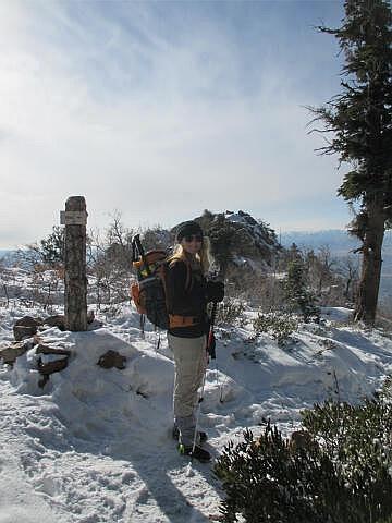
Winter Climbing:
The 9026' south summit of
Mount Olympus is climbed year round by experienced hikers and
mountaineers. If you attempt this
summit in winter I suggest you bring good waterproof boots, gaiters and ski
or trekking poles. In late winter and early spring the snow will be
approximately 10 to 15 feet deep on the summit. I have never required
snowshoes to summit since the trail is usually well traveled and packed. If
you want to snowshoe there are much better adventures to be found. Avalanche
danger is minimal on this winter climb but as always, precautions should be
taken. The summit ridge can be heavily corniced and very dangerous in
winter. Approach the summit ridge with extreme caution in winter conditions.
You have been warned!
 |
 |
Trailhead Information:
The Mount Olympus
Trailhead is located east of Salt Lake City on Wasatch Boulevard. If you are
traveling north on I-215 take the 3900 South exit to Wasatch Boulevard, then
turn south and drive for 2.3 miles. If you are driving south on I-215 take
the 4500 South exit to Wasatch Boulevard, than continue south for 1.6 miles.
There is a paved parking lot on the east side of Wasatch
Boulevard which is signed "Mt. Olympus Trailhead". The parking lot is also
referred to as "Pete's Rock" in the local climbing community.
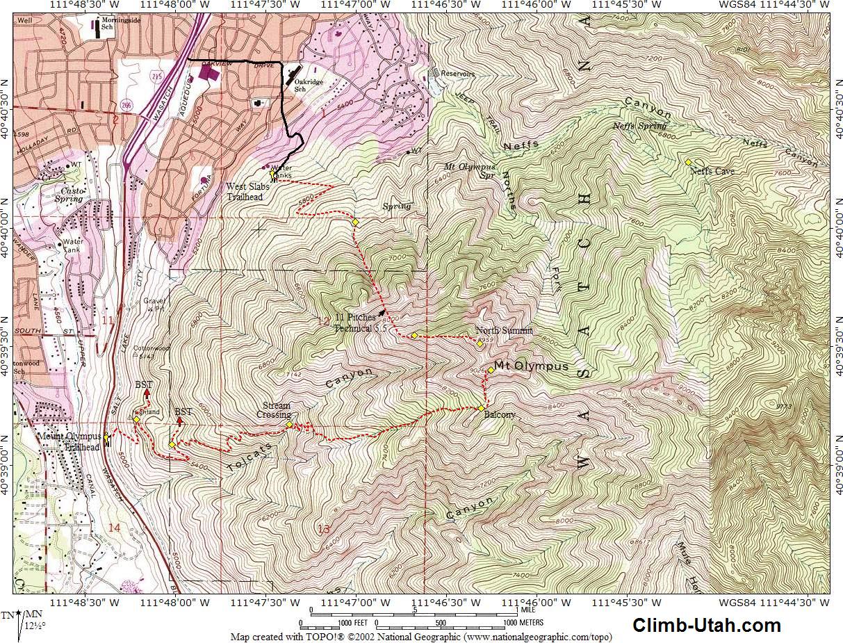
Route Information:
From the
Mount Olympus Trailhead (N40° 39' 07", W111° 48' 23"), walk to the
south end of the parking lot and follow the steep trail up to the top of
Pete's Rock. From the top of Pete's Rock just follow the main trail as it
snakes east up the mountain. After hiking approximately 1/2 mile you will
come to a major trail junction (N40° 39' 12", W111° 48' 13"). The trail
to the left (north) is part of the Bonneville Shoreline Trail (BST). Take
the trail to the right and continuing hiking approximately 1/2 mile until
you encounter a second major trail junction (N40° 39' 05", W111° 48'
01"). The trail to the left (north) is part of the Bonneville Shoreline
Trail. Take the trail to the right and continuing hiking.
One mile after leaving the second BST trail junction the trail will cross
the seasonal stream in Tolcats Canyon (N40° 39' 11", W111°
47' 22"). You will often find flowing water in the stream from spring through early
summer. A general rule is if you can see snow from the valley floor between
the north and south summits of Mount Olympus you will find water in the
stream. Hiking to the stream is a popular destination for many. The stream
is never raging or difficult to cross.
As the trail crosses the stream it begins to
zigzag up what is known as "Blister Hill". 1-1/4 mile after crossing the
stream the trail reaches a magnificent viewpoint known as "The Balcony"
(N40° 39' 14", W111° 46' 18"). The
Balcony offers spectacular views into Heughs Canyon and
Twin Peaks to the south.
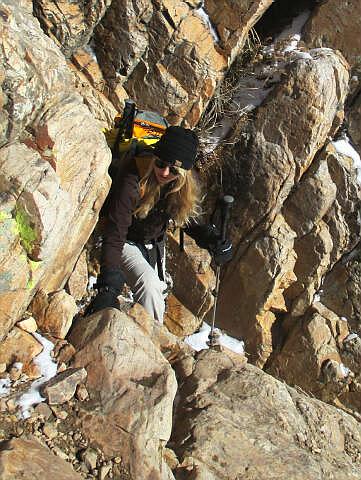
At the Balcony the trail turns north and
climbs 1/4 mile to the south summit of Mount Olympus (N40° 39'
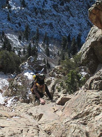
25", W111° 46' 15"). The last section of trail requires some minor
scrambling. The route is never difficult or exposed. If you encounter a
difficult or exposed section you are off course, at which point you need to
backtrack and locate the correct route. Enjoy the summit view, it is magnificent.
Video:
Enjoy a short video
of a hike to the south summit of 9026' Mount Olympus.
Mount Olympus:
Length: 3 1/2 miles - One Way.
Time: 3 hours - One Way.
Trailhead: 4,925'
Summit: 9,026'
Skill Rating: Moderate
Summer Equipment: None
Winter Equipment: Waterproof Boots, Gaiters and Ski Poles.
Water: 3 liters per person minimum.
Difficulties: Minor Scrambling
Circle Trip: No
Warnings: Minor Exposure & Winter Avalanche Danger.
Related Link:
Climbing the North Face of
Mount Olympus
[
Homepage
] [ Introduction ] [
Warning ] [
Ratings ] [
Ethics
] [ Feedback ] [
Updates ]
© Copyright
2000-, Climb-Utah.com |