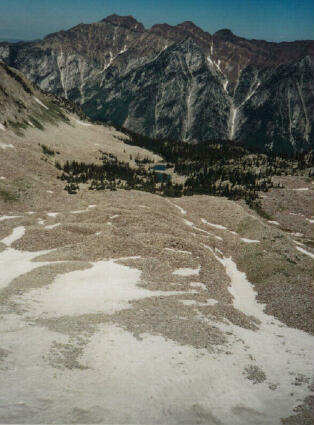
[ Homepage ] [ Introduction ] [ Warning ] [ Ratings ] [ Ethics ] [ Feedback ] [ Updates ] Red Pine Lake & Maybird Gulch Little Cottonwood Canyon Wasatch Mountains Hiking The hike to Red Pine Lake is one of the most popular hikes in the Wasatch Mountains. The lake is located in the Lone Peak Wilderness Area. Red Pine Canyon contains two beautiful alpine lakes, which are accessible to beginning hikers. Experienced hikers requiring a little more adventure can continue on to the summit of the 11,326' Pfeifferhorn. Red Pine Lake is also a popular winter snowshoe destination. Hikers looking for solitude head for the seldom visited but extremely beautiful Maybird Gulch. Maybird is less crowded and more dramatic than Red Pine with spectacular views of the 11,326' Pfeifferhorn.
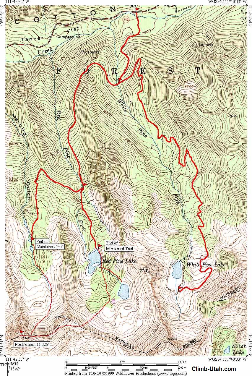
From I-15 in Sandy, Utah take Exit #298 (9000 South) and head east on Highway 209 (9000 South) for 6.9 miles at which point Highway 209 joins Highway 210 (Little Cottonwood Canyon Road) at a Y-Junction. All mileage in this canyon is measured from this Y-Junction. The junction is identified be a huge flashing message board on the south side of the road and a park and ride lot on the north side of the canyon. The park and ride lot has a restroom. The White Pine Trailhead is located 5 1/2 miles up Little Cottonwood Canyon from the Y-Junction and 3/4 mile below Snowbird Ski Resort on the south side of the road. The Trailhead is signed with paved parking, vault toilet and information kiosk.
 The
hike starts at the White Pine Trailhead and is suitable for beginners. The trail is
well maintained and signed. A paved path leads from the parking area to a footbridge
over Little Cottonwood Creek. The route follows a old 4-wheel drive track, which is
now closed. The trail climbs to the southwest into White Pine Canyon. One
hundred yards after crossing the footbridge the trail forks. The right fork leads
down to a stream side meadow, take the left fork, which climbs upward. 1-mile from
the trailhead the trail meets the stream in White Pine Canyon. The 4-wheel drive
track continues to White Pine Lake, the
signed trail to Red Pine Lake and Maybird Gulch crosses the stream on a footbridge 50
yards upstream. The
hike starts at the White Pine Trailhead and is suitable for beginners. The trail is
well maintained and signed. A paved path leads from the parking area to a footbridge
over Little Cottonwood Creek. The route follows a old 4-wheel drive track, which is
now closed. The trail climbs to the southwest into White Pine Canyon. One
hundred yards after crossing the footbridge the trail forks. The right fork leads
down to a stream side meadow, take the left fork, which climbs upward. 1-mile from
the trailhead the trail meets the stream in White Pine Canyon. The 4-wheel drive
track continues to White Pine Lake, the
signed trail to Red Pine Lake and Maybird Gulch crosses the stream on a footbridge 50
yards upstream.
After crossing the stream, the trail leads west in a rising traverse around the ridge, through a wooded section, into Red Pine Canyon. As you cross the ridge between White Pine and Red Pine Canyon you enter into the Lone Peak Wilderness Area. The trail continues up Red Pine Canyon until the trail and the stream in Red Pine Canyon converge at the Maybird Gulch turn-off. This trail junction is 2 1/2 mile from the trailhead. The trail to Maybird Gulch crosses the stream on a footbridge. The trail to Red Pine Lake continues up the east side of the Red Pine stream. Red Pine Lake Trail: The trail to Red Pine Lake will pass a mine dump 75 yards after the trail junction. From the mine dump the trail climbs for anther 3/4 mile before reaching Lower Red Pine Lake. This is the end of the maintained trail. Upper Red Pine lake is reached by following the hiker made trail up the east side of the stream, which flows into Lower Red Pine Lake. Maybird Gulch Trail: The trail to Maybird Gulch cross the footbridge at the trail junction makes a switchback as it climbs the hill and heads west as it crosses the ridge into Maybird Gulch. The trail continues climbing steadily to Maybird Lake, which is the end of the maintained trail. General Information:
Upper Red Pine Lake Maybird Gulch [ Homepage ] [ Introduction ] [ Warning ] [ Ratings ] [ Ethics ] [ Feedback ] [ Updates ] © Copyright 1999-, Climb-Utah.com |
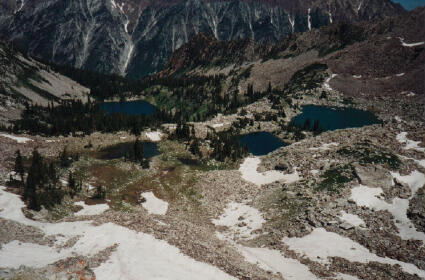
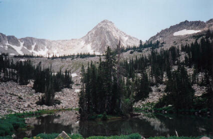 Lower Red Pine Lake