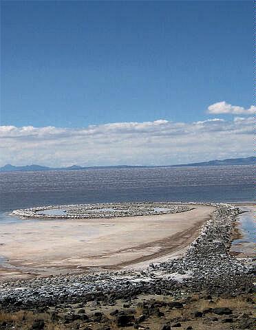
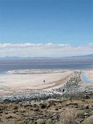
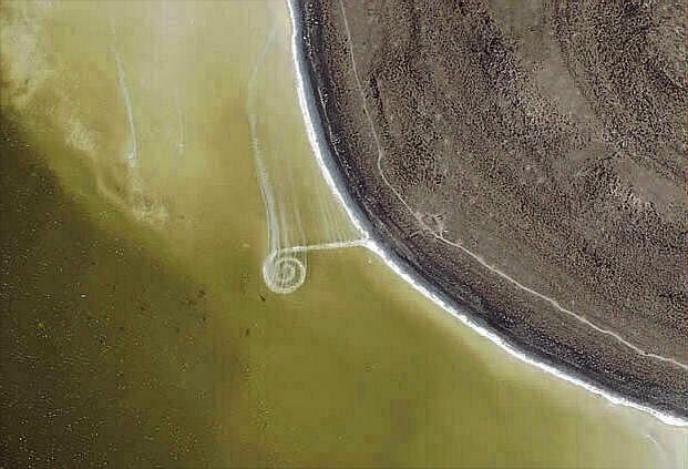
 Robert
Smithson's famous earthwork Spiral Jetty (April 1970) is located in the north arm on the
Great Salt Lake in Utah. Using black basalt rocks and earth from the site, the artist
created a coil 1500 feet long and 15 feet wide that stretches out counterclockwise into
the translucent red water. Spiral Jetty was acquired by Dia Art Foundation as a gift from
the Estate of the artist in 1999. Robert
Smithson's famous earthwork Spiral Jetty (April 1970) is located in the north arm on the
Great Salt Lake in Utah. Using black basalt rocks and earth from the site, the artist
created a coil 1500 feet long and 15 feet wide that stretches out counterclockwise into
the translucent red water. Spiral Jetty was acquired by Dia Art Foundation as a gift from
the Estate of the artist in 1999.
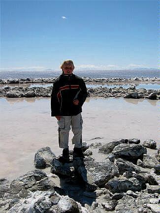
Walking the length of the jetty is not difficult. The surface is rocky and uneven, but not hard to walk on. It merely requires your attention. It is a good idea to wear shoes that you can wade in. The lake level varies several feet from year-to-year and from season to season, so the Spiral Jetty is not always visible above the water line. At the time of construction the elevation of the north arm of the Great Salt Lake was reported to be 4,195 feet. Most the pictures on this page were taken with a true USGS Lake elevation of 4,195.10 feet. When the Great Salt Lake reaches an elevation above 4,197 feet only the tops of some of the jetty rocks can be seen poking above the surface of the water. Therefore, to view the jetty from ground level, the lake elevation can be no higher that 4,197 feet. Typically, the Great Salt Lake is at its lowest levels in October and November of each year. You can visit the USGS web page to get the current elevation of the Great Salt Lake. The USGS measurement is for the north arm of the Great Salt Lake near Salina, Utah.
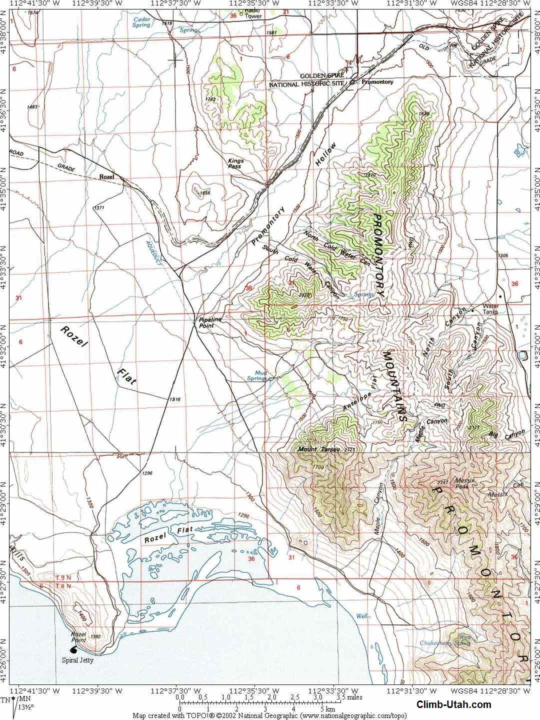
To visit the Spiral Jetty you must first find the Golden Spike National Historic Site, which is approaximately 32 miles west of Brigham City, Utah. Travelers coming from Salt lake and Ogden should take I-15 north to Exit 365, drive west on Highway 13, through Corinne, for 2.7 miles to a fork in the road. Take Highway 83 (left fork) and follow it west for 17.9 miles to Lampo Junction. Turn left and follow the signs 7.8 miles to the Golden Spike Visitor Center. The actual Spiral Jetty driving description begins at the Golden Spike National Historic Site. The road to the Spiral Jetty is a maintained dirt road. The road is passable to all vehicles in good weather conditions. All junctions are currently signed "Spiral Jetty" and the route is easy to follow. From the Golden Spike Visitor Center drive 5.6 miles west on the main gravel road to a fork. The west fork continues straight ahead, take the south (left) fork. Drive 1.3 miles to a second fork in the road. The east fork (straight ahead) continues south along the west side of the Promontory Mountains. Take the southwest (right) fork. Drive 8.2 miles to the tip of Rozel Point and a fork in the road. This is an excellent place to park. The road from this point on is extremely rough and suitable for high clearance vehicles only. The south (left) fork drops down 200 yards to a jetty (not the Spiral Jetty) left by oil drilling exploration in the 1920s through the 1980s. Take the west (right) fork and pass by assorted trash consisting of a large white trailer, an amphibious landing craft and an old Dodge truck. Drive or walk 0.6 miles west-northwest around Rozel Point and look toward the Lake. The Spiral Jetty (N41° 26' 17", W112° 40' 02"), should be in sight providing the lake elevation is below 4,197 feet.
© Copyright 2000-, Climb-Utah.com |