[
Homepage ] [
Introduction ] [
Warning ] [
Ratings
] [ Ethics ] [
Feedback ] [
Updates ]
 |
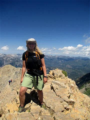
Mount Timpanogos
Elevation 11,749'
Mount Timpanogos Wilderness Area
American Fork Canyon / Provo Canyon
Mount
Timpanogos is the most popular mountain hiking destination in Utah. Timpanogos has
everything that a hiker could wish for including an alpine lake, a small glacier,
waterfalls, high alpine meadows, wildflowers, a herd of Rocky Mountain Goats and an easily
accessible summit. There is also the wreckage of an Air Force B-25 for the really
adventurous. |
General Information:
  The
summit of Mount Timpanogos is 11,749', second highest in the Wasatch
Mountains. I consider the hike from the Timpooneke Trailhead to be the best
hike in Utah. Reaching the summit will require 4 1/2 hours. The summit is 7
1/2 miles one-way with an elevation gain of 4580' on a well-maintained
trail. For the less adventurous, Emerald Lake is 6 1/2 miles one-way with an
elevation gain of 3210' and will require 3 1/2 hours. The
summit of Mount Timpanogos is 11,749', second highest in the Wasatch
Mountains. I consider the hike from the Timpooneke Trailhead to be the best
hike in Utah. Reaching the summit will require 4 1/2 hours. The summit is 7
1/2 miles one-way with an elevation gain of 4580' on a well-maintained
trail. For the less adventurous, Emerald Lake is 6 1/2 miles one-way with an
elevation gain of 3210' and will require 3 1/2 hours.
The Timpooneke trail is accessible to hikers of all abilities
from mid-July until the first major snowstorm of the year. The only real difficulty
with the hike is that it requires a very long day for the average
hiker. Water is accessible from several locations along the trail; all water
should be filtered. This hike is extremely crowded on Saturday. Hiking on Sunday
or mid-week will provide a more pleasant and secluded experience.
About the second week of August Timpanogos Basin explodes with the color of
radiant wild flowers. Around the first week of October the autumn leaves
begin to change color and provide a spectacular setting.
A GPS might be helpful, but is not required for this route. The USGS 7.5'
Map titled "Timpanogos Cave" shows the area described. Navigation for this
route is moderate. Mount Timpanogos follows a well maintained trail all the
way to the summit. All waypoints and maps for the Mount Timpanogos hike use
the WGS84 datum.
Timpooneke Trailhead:
Drive
up American Fork Canyon until the road forks. Take the right (south) fork, which is part of
the Alpine Loop. Continue driving until you reach a sign on the right side of the
road that points to the Timpooneke campground. Take this paved side road 1/4 mile
through the campground. Just past the campground the road reaches the trailhead which
is identified by a large paved parking lot with a vault toilet on the left side of the
road.
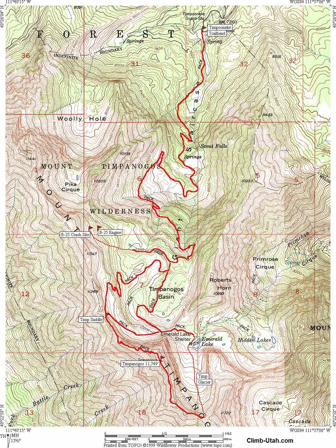
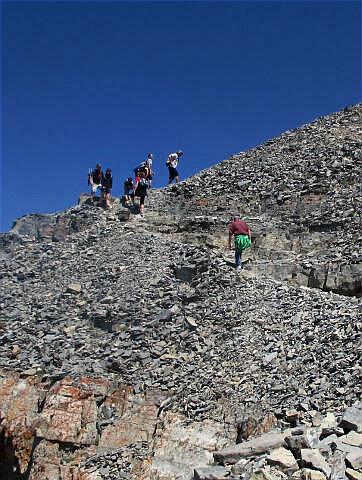
Timpooneke Route:
The
trail begins near a small forest service shelter with information and map boards (N40°
25' 52", W111° 38' 21"). The trail
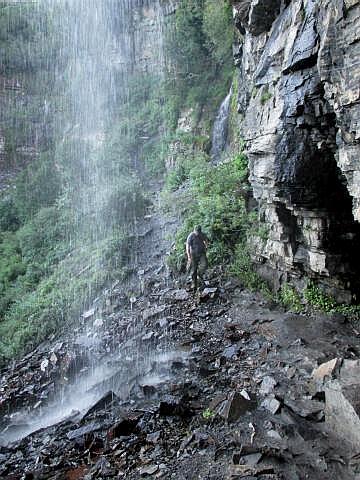
heads up a glacier valley known as the Giant Staircase. After about 1 mile you will
pass a sign pointing to Scout Falls. Just above the Scout Falls trail there are
several switchbacks. Above the switchbacks you enter Middle Basin which is littered
with avalanche debris. The trail makes big loops and switchbacks through Middle Basin
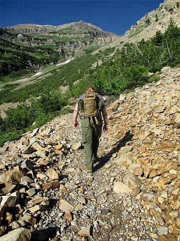
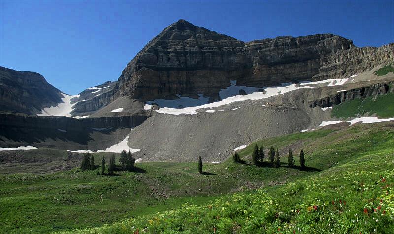
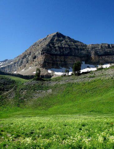
to gain altitude. After climbing the headwall the trail enters Timpanogos
Basin. You should now have your first views of the summit and Timpanogos Glacier. The
glacier is actually a perpetual snowfield and not a true glacier.
From
the lip of Timpanogos Basin you will encounter a trail which is signed toilet and leads to
the right (N40° 24' 11", W111°
38' 39"), this is also the trail to the
B-25 Crash Site. To reach the summit continue hiking on the main trail (trail to the
left). Several 100 yards further up the trail you will encounter a second junction (N40°
24' 6", W111° 38' 41"). The
trail on the left leads to Emerald Lake, the trail on the right leads to the summit. Take
the summit trail and walk through lush meadows that are often referred to as the Flower
Garden. The first part of August is the best time to see the flowers. Continue
following the trail as it climbs to the Timp Saddle (N40° 23' 46", W111°
39' 17").
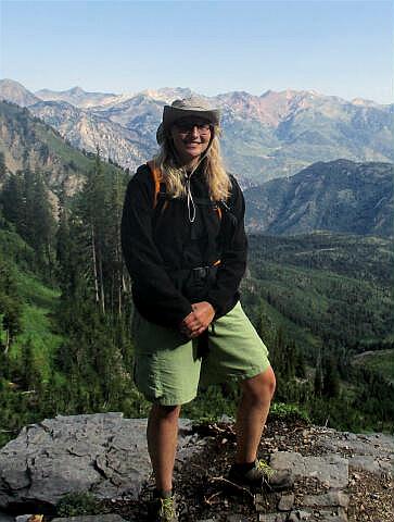
From
Timp Saddle with it's fantastic views of Utah Valley continue south along the
ridge following the well-defined trail. You
will soon arrive at The Stairs, which is where the trail zigzags up a steep
canyon. From here continue to the Glass House which marks the summit (N40°
23' 27", W111° 38' 44"). Surveyors
who, before the days of aerial mapping, used the peak as a triangulation point originally
constructed the steel and glass shelter. The Glass was blown out years ago.
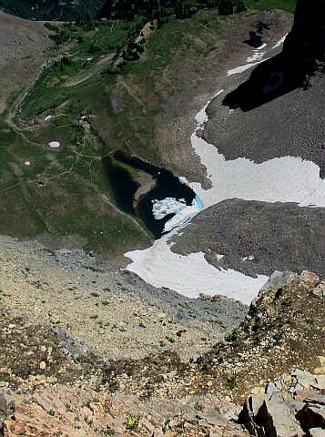
From
the summit continue 1/2 mile south along the ridge trail until you arrive at the Glacier
Saddle (N40° 23' 2", W111°
38' 19"). Slide and hike down the
glacier to Emerald Lake (N40° 23' 37, W111° 38'
25"). Use caution and commonsense
while on the glacier. Most Timpanogos accidents happen on the glacier. From Emerald
Lake take the trial which leads to the Timpooneke trailhead and the junction we passed
when entering Timpanogos Basin.
 |
 |
B-25 Crash Site:
The trail to the B-25 Crash site
leaves the main Timpooneke trail at the lip of Timpanogos Basin. From the lip of
Timpanogos Basin you will encounter a trail which is signed toilet and leads to the
north (right),
this is also the trail to the B-25 Crash Site. Follow the trail north 1/2 mile as it
contours around a hill and than follows a small stream to two ponds. The trail disappears
as it approaches the ponds. From the ponds the B-25 wreckage is located 1/ 2 mile
west-northwest at the base of the scree field at an elevation of 10,800'. The easiest way
to locate the wreckage is to climb west up two terraces to the base of the scree. Follow
the base of the scree north and you will walk into the middle of the wreckage. Debris from
the wreckage is scattered from the base of the scree, across the first terrace and down to
the second terrace. The large radial motors are very easy to locate, one
engine is located
on the upper terrace (N40° 24' 25", W111°
39' 23") and one is located on the lower terrace (N40° 24' 26", W111°
39' 19"). The wreckage remains buried under snow until early to
mid August.
It is possible to contour south
along the terrace, which the crash site is on, and intersect the Timpooneke trail as it
approaches the Timp Saddle. If you are heading to the summit the detour to the crash site
will add one hour to your trek.
 |
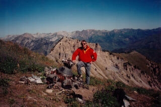 |
B-25 Crash
History:
The U.S. Air Force B-25 crashed on
the afternoon of March 9, 1955. The day was stormy with the local mountains reporting
18" of new snow. The plane carried three crewmembers and two passengers. The plane
began its fight in Great Falls, Montana, made a fuel stop at Hill Air Force Base in Ogden,
Utah, and departed for March Air Force Base in Riverside, California. Sometime after 7:30
p.m. the B-25 became lost in the weather and crashed on the east side of Timpanogos.
Killed in the crash was the pilot Major D.C. Holley, co-pilot 1st Lieutenant H. E. St.
John, Airman 1st Class D. H. Dempsey, civilian crew chief M. J. McNalty and civilian D. R.
Cubbage.
Video:
Enjoy a short video
of a hike to the summit of 11,749' Mount Timpanogos.
Related Link:
Timpanogos Cave
[
Homepage
] [ Introduction ] [
Warning ] [
Ratings ] [
Ethics
] [ Feedback ] [
Updates ]
© Copyright
2000-, Climb-Utah.com |