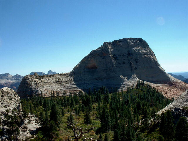
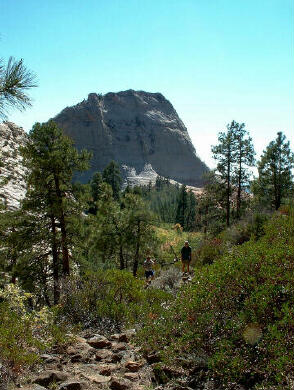
[ Homepage ] [ Introduction ] [ Warning ] [ Ratings ] [ Ethics ] [ Feedback ] [ Updates ] North Guardian Angel Zion National Park 7395' North Guardian Angel is a fun and exciting mountain scramble located in Zion National Park. From the summit you will be presented with outstanding views of the Left Fork of North Creek (The Subway) and many other interesting features.
  North
Guardian Angel is a mountain scramble which will require 4 to 5 hours to complete. No car
shuttle is required. A climbing rope and a couple of slings might be required for
handlines and non climbers. Since the route contains some loose rock I suggest a
group size of four or less along with helmets. A good sticky approach shoe or climbing
shoe is a bonus but I did the route in running shoes with no problems. I guess wear them
if you brought them is the motto.
North
Guardian Angel is a mountain scramble which will require 4 to 5 hours to complete. No car
shuttle is required. A climbing rope and a couple of slings might be required for
handlines and non climbers. Since the route contains some loose rock I suggest a
group size of four or less along with helmets. A good sticky approach shoe or climbing
shoe is a bonus but I did the route in running shoes with no problems. I guess wear them
if you brought them is the motto.
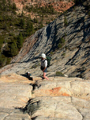
"The Guardian Angels" is the USGS 7.5 minute topographical map which show North Guardian Angel. Navigation for this adventure is easy and no permit is required. All waypoints and maps for North Guardian Angel use the WGS84 datum. Always check your GPS to ensure that WGS84 is the datum before entering a waypoint into your unit. This route is rated as class 4 using the Yosemite Decimal System (YDS).
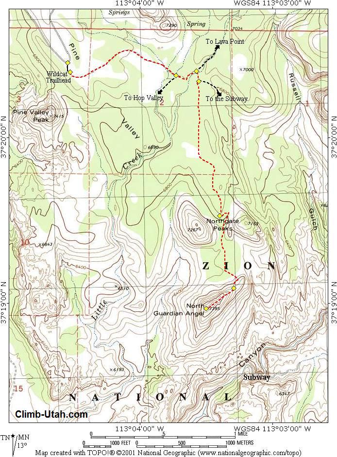
From the Zion Canyon Visitor Center drive west on Highway 9 to the town of Virgin. From Virgin turn right (north) on the signed Kolob Reservoir Road. Travel 15.3 miles on the paved road to the signed Wildcat Trailhead. The trailhead has parking available for a number of vehicles. Any vehicle can easily reach the trailhead.
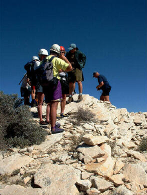
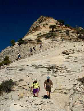
From the Wildcat Trailhead (N37° 20' 24", W113° 04' 32") begin hiking the signed Wildcat connector trail east. After 1 mile you will come to a junction (N37° 20' 23", W113° 03' 43"). The right fork leads to the Hop Valley Trailhead, take the left fork and continue for 300 yards to a junction (N37° 20' 25", W113° 03' 35"). The left fork leads to Lava Point, take the right fork and hike for 100 yards to a junction (N37° 20' 21", W113° 03' 34"). The left fork leads to "The Subway", take the right fork and continue hiking for 1 mile to the Northgate Peaks Viewpoint (N37° 19' 32", W113° 03' 34") at the top of a lava rock outcrop. This is the end of the maintained trail. From the viewpoint you should have an excellent panorama of your intended victim, the North Guardian Angel. While standing at the viewpoint it is a good time to take note of the remainder of your route since it is completely visible. Our intended route is to climb to the nice flat ridge which extends east from the main summit and than scramble up the ridge to the summit. From the Viewpoint hike down the east side of the lava outcrop on a hiker made trail to the canyon bottom. Follow the canyon bottom south until the drainage turns west. When the drainage turns west you must keep heading south to the base of North Guardian Angel. Hike to the top of the flat ridge extending east from the main summit (N37° 19' 06", W113° 03' 18"). It is actually quite easy to hike to the top of the flat ridge using the minor ledges as a stairway. This section looks difficult from a distance, but it is not. From the top of the flat ridge you should have your first good views into the Left Fork of North Creek. If the hike to this point was intimidating you should consider this the end of the trail. This is where the scrambling with exposure begins. Please remember that whatever you climb up you must climb down. If the route becomes to difficult backtrack and look for an easier path or improve your skills and visit again at a latter date. From the top of the flat ridge the route follows a ledge to the north and than climbs a crack to easier ground at the base of a tree on the ridge. This is probably the most difficult and scary section and non climbers might wish to be belayed. From here on up there is really no correct path to the summit, the route generally follows the ridge to the summit (N37° 18' 58", W113° 03' 30"). Most obstacles from this point on can be bypassed by dropping slightly down on the south side as required. Basically just follow the the path of least resistance. Don't forget to sign the summit register. Optional
Information: It is possible for the experienced to complete this route as a traverse over the summit and down the southwest ridge. The basic route drops down off the south side and than traverses back to the ridge at the base of the summit nose. [ Homepage ] [ Introduction ] [ Warning ] [ Ratings ] [ Ethics ] [ Feedback ] [ Updates ] © Copyright 2000-, Climb-Utah.com |