[
Homepage ] [
Introduction ] [
Warning ] [
Ratings
] [ Ethics ] [
Feedback ] [
Updates ]
 |
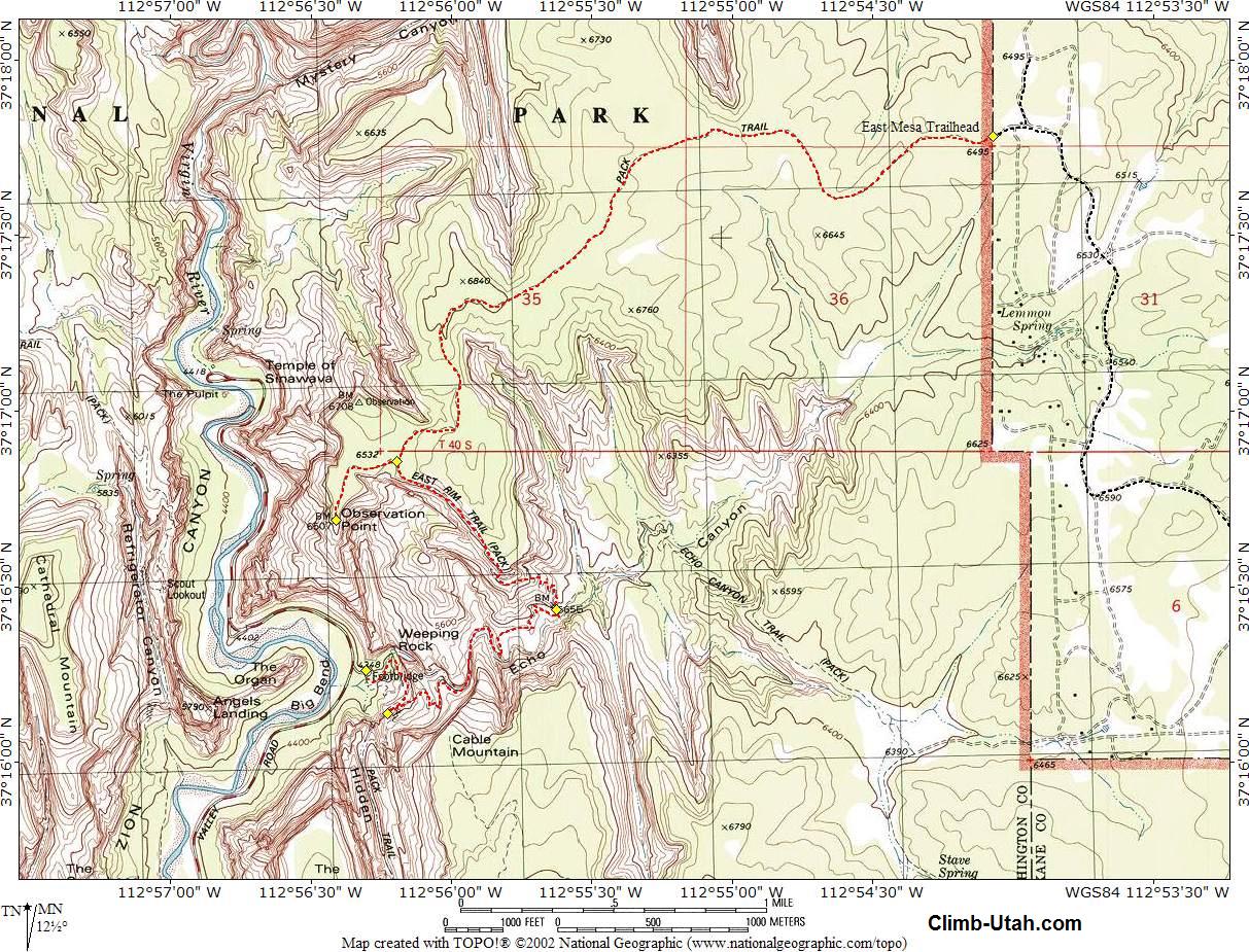
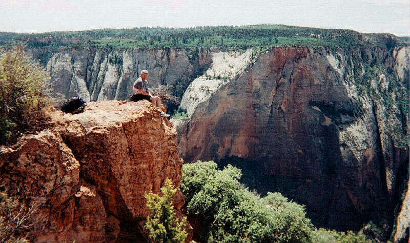
Observation Point
Zion National Park
Hiking
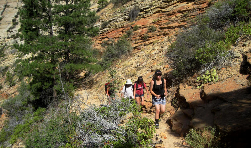
Observation Point is consider one of
the classic hikes inside Zion National Park. There are two methods for
completing this hike. The classic route begins at the Weeping Rock
Trailhead and snakes up Echo Canyon. The easy route involves a long
drive to reach the East Mesa Trailhead. Both route options are presented
below and both routes have their own charm.
|
General Information:
  Observation Point is a great hike that contains no obstacles. The route is 8
miles from trailhead to summit using the classic Weeping Rock Trailhead and
contains 2000' of elevation gain. This option will require 4 to 6 hours for
a round trip. The route is 7 miles from trailhead to summit using the East
Mesa Trail with 200' of elevation gain. This option will require 3 to 4
hours for a round trip.
Observation Point is a great hike that contains no obstacles. The route is 8
miles from trailhead to summit using the classic Weeping Rock Trailhead and
contains 2000' of elevation gain. This option will require 4 to 6 hours for
a round trip. The route is 7 miles from trailhead to summit using the East
Mesa Trail with 200' of elevation gain. This option will require 3 to 4
hours for a round trip.
Using either option this hike can be very hot during midday.
Every member of your party should carry a minimum of two liters of water.
This hike is accessible year round and is suitable for older children and
anyone else that enjoys a long walks in the woods. This is a good ramble for
properly conditioned novice hikers. Anyone
lacking commonsense should avoid this hike.
Navigation for this route is easy. A GPS is a waste of time, but I have
included the waypoints because I'm a nice guy. Good map reading skills are wasted on
this hike, you will be following a well traveled and well signed trail. "Temple of Sinawava" is
the USGS 7.5 minute topographical map that shows Observation Point. All waypoints and maps for this route
use the WGS84 datum.
 |
 |
Weeping Rock Trailhead:
Logistically reaching Weeping Rock is by
far the easiest of the two trailheads. From the Zion Canyon Visitor Center
just take the Zion Canyon Shuttle to Weeping Rock and get off at the
announced stop. The trailhead consists of restrooms and a couple of
information kiosks. The trail to Observation Point is well signed and easy
to find and follow.
East Mesa Trailhead:
The
easiest hiking route to Observation Point is by beginning at the East Mesa
Trailhead. To reach the trailhead
drive to the East Entrance of Zion National Park. From the East Entrance drive east 2.4 miles on highway
9. Turn left at the signed "North Fork" junction. Drive 5.2 miles to signed
"Zion Ponderosa Resort". Turn left and enter the Zion Ponderosa (N37° 16'
22", W112° 52' 24"). From here, you will be driving on dirt roads. The
Zion Ponderosa is private property, please respect this trailhead access.
You will be crossing cabin sites with many spur roads, stay on the main road
until told to turn off. You will be heading toward the Observation Point
Trailhead, sometimes there are signs, other times they have been removed.
After
entering the Zion Ponderosa, stay on the main road (do not turn left to the resort) and
drive 0.7 miles to signed Cable Mountain, Observation Point road fork (N37° 16' 33",
W112° 53' 02"). Take the right fork and drive 0.7 miles to a tee in the road
(N37° 16' 47", W112° 53' 45"). Turn right, and drive 1.1 miles until
road forks around a large ponderosa pine (N37° 17' 43", W112° 53' 49").
Take the right fork and drive 0.2 miles to a spur road on the left (N37° 17'
51", W112° 54' 00"). Take the spur road to the left and drive 0.1
miles. The road ends at a fence, which is the Zion Park boundary. There are no
signs at the trailhead (N37° 17' 47", W112° 54' 04"), it just ends
at a national park boundary fence.
Weeping Rock Trail:
From Weeping Rock
Trailhead (N37° 16' 16", W112° 56'
18") follow the well signed trail east. After 3/4 mile you will reach a
junction (N37° 16' 08", W112° 56'
14"), take the signed trail east (left). Hike an additional 1 1/2 miles
east, as the trail continues to climb Echo Canyon, to a second junction (N37° 16'
26", W112° 55'
38"). Take the signed trail north (left). Follow the trail 1 1/4 mile
as the trail continues to climb to a third junction (N37° 16' 52", W112° 56'
12"), take the signed trail west (left) and hike 1/2 mile to Observation
Point (N37° 16' 41", W112° 56' 25"). Enjoy the view.
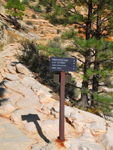
East Mesa Trail:
From
the East Mesa Trailhead (N37° 17' 47", W112° 54' 04") cross
the fence at the access point 40 feet south and begin walking west on the
well-traveled East Mesa Trail. Hike west for 3 miles to a signed junction
(N37° 16' 52", W112° 56' 12"), take the signed trail west (straight ahead)
and hike 1/2 mile to Observation Point (N37° 16' 41", W112° 56' 25"). Enjoy
the view.
Combo Platter:
It's becoming popular to setup a shuttle or use a
commercial shuttle to the East Mesa
Trailhead and hike to Observation Point, and than continue hiking down the
trail to the Weeping Rock Trailhead. The entire hike is downhill when using
this option and the scenery is always changing.
[
Homepage
] [ Introduction ] [
Warning ] [
Ratings ] [
Ethics
] [ Feedback ] [
Updates ]
© Copyright
2000-, Climb-Utah.com |