[
Homepage ] [
Introduction ] [
Warning ] [
Ratings
] [ Ethics ] [
Feedback ] [
Updates ]
 |
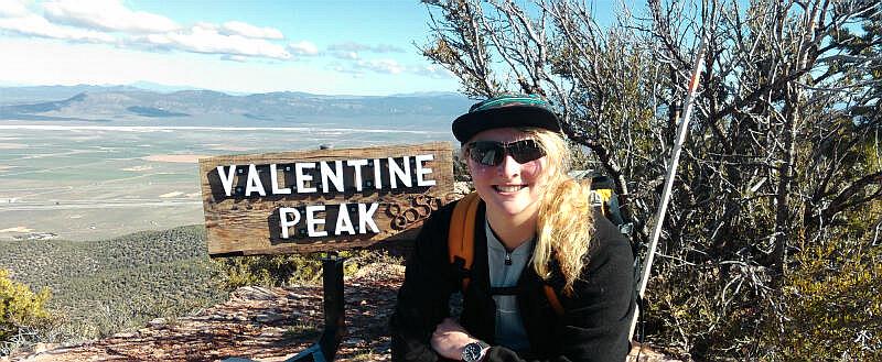
Valentine Peak
Elevation 8050'
Parowan
Hiking
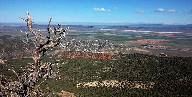
The town of Parowan, Utah has a fantastic hiking trail known as
Valentine Peak. This trail has existed in some fashion for many years,
but has recently been signed and improved making it a great little hike.
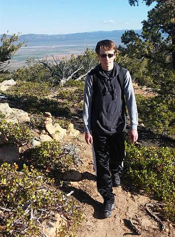
From the summit you have views the Parowan Valley, the Parowan Gap, the
Tushar Mountains. |
General Information:
  The trip from trailhead to the summit of Valentine Peak is 3 1/2 miles, and
will require about 2 1/2 hours. You will encounter 1,930' of elevation gain on
the hike to the summit. The route is
rated 1 II using the Yosemite Decimal System (YDS). The
summit is often hiked year round by experienced hikers and those with
snowshoes.
Beginners will find spring, summer and fall to be the preferred months to climb this
mountain. This trail is suitable for most adults, fit seniors, and older
children. There is nothing dangerous about this hike if commonsense is used.
The trip from trailhead to the summit of Valentine Peak is 3 1/2 miles, and
will require about 2 1/2 hours. You will encounter 1,930' of elevation gain on
the hike to the summit. The route is
rated 1 II using the Yosemite Decimal System (YDS). The
summit is often hiked year round by experienced hikers and those with
snowshoes.
Beginners will find spring, summer and fall to be the preferred months to climb this
mountain. This trail is suitable for most adults, fit seniors, and older
children. There is nothing dangerous about this hike if commonsense is used.
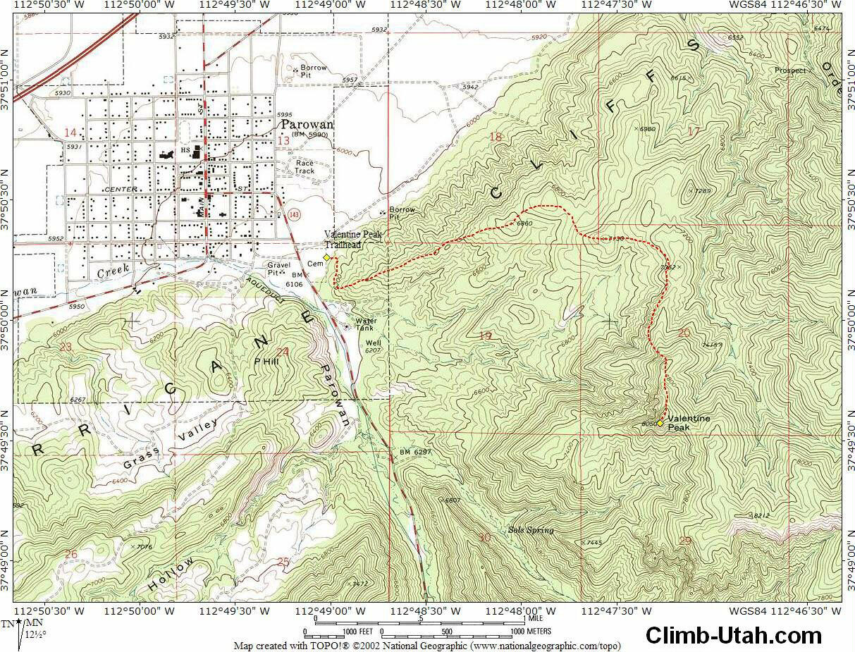
A GPS is not required for this hike, but the GPS waypoints are provided for
the electronic nerds. The USGS 7.5'
Map titled "Parowan" shows the area described. Navigation for this route
is easy. Valentine Peak follows a trail all the way to the summit. All waypoints and maps for the
Valentine Peak use the WGS84
datum.
History:
Valentine
Peak is the red-rock bluff to the east of town and can be seen from the
entire valley. The peak was named because on Valentine’s Day one can stand
at the corner of 500 West and Center Street and the watch the sun rise
directly over the center of the peak, which is how it became known as
"Valentine Peak". Vito Locatelli of Parowan is given much of the credit for
constructing and maintaining the trail as it is today.
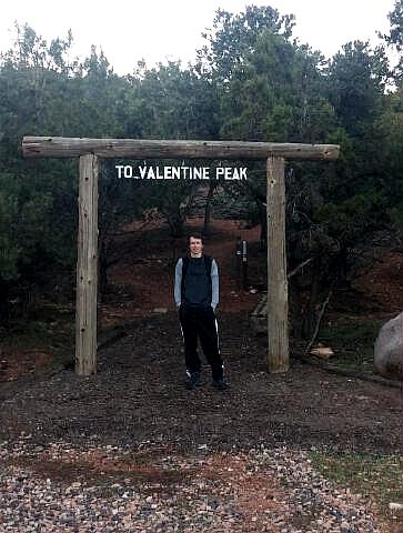
Trailhead Information:
From I-15 take
Parowan Exit #78, turn east on Main Street and drive 1.2 miles. Turn east
(left) on Center Street and drive 0.3 miles, continue onto South Canyon Road
for and additional 0.3 miles. Turn east (left) on City View Drive and follow
the road 0.1 miles to the east side of the cemetery and the Valentine Peak
Trailhead. The trailhead is identified by a large log arch with the words
"Valentine Peak" across the top.
 |
Route Information:
From the
Valentine Peak Trailhead (N37° 50' 16", W112° 49' 01"), walk under
the wooden arch and head east up the trail. As you crest the first ridge you
will find a pair of bench on either end of the ridge. The second bench is an
indicator that you have hiked approximately 1 mile. The trail snakes through
juniper trees and passes several benches and chairs as it climbs to the
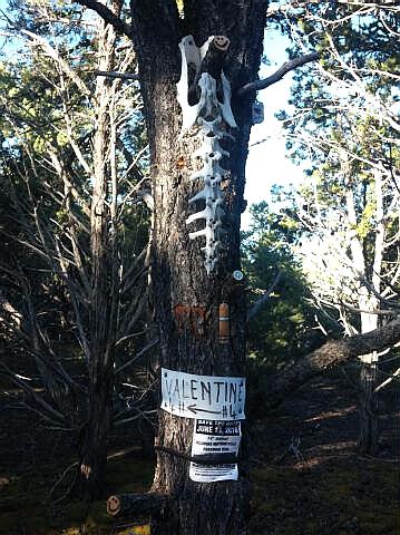
summit. The trail is extremely well marked with signs telling you how far
you have hiked and far you have left to go. Near the top the trail steepens
and teases you with a false summit approximately 1/2 mile before the actual
summit of Valentine Peak (N37° 49' 34", W112° 47' 17").
Valentine Peak:
Length: 3 1/2 miles - One Way.
Time: 2 hours - One Way.
Trailhead: 6,120'
Summit: 8,050'
Skill Rating: Easy
Summer Equipment: None
Winter Equipment: Waterproof Boots, Gaiters, Ski Poles and snowshoes.
Water: 3 liters per person minimum.
Difficulties: None
Circle Trip: No
Warnings: Minor Winter Avalanche Danger.
[
Homepage
] [ Introduction ] [
Warning ] [
Ratings ] [
Ethics
] [ Feedback ] [
Updates ]
© Copyright
2000-, Climb-Utah.com |