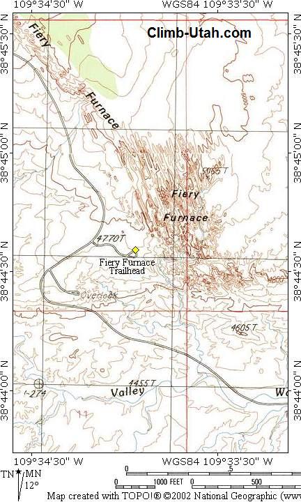
General Information: Navigation for this route is extremely difficult. A GPS is useless in this puzzling maze. The USGS 7.5' Maps titled "The Windows Section" and "Mollie Hogans" show the Fiery Furnace. All waypoints and maps for this route use the WGS84 datum. This canyon has a minor flash flood danger. In normal conditions the route will contain a couple small water filled potholes that can usually be avoided with minor effort. There are two rappels in the canyon with the highest being 130-feet. Two 60-meter ropes are required for this route, additional gear should consist of several shoulder length slings, a couple double length slings, 100 feet of webbing, several rapid links, and a prusik system. The anchors in this canyon are all easy to locate, but the first anchor requires a substantial amount of webbing to create, make sure you are carrying at least 100-feet. Warning:
Every visitor entering the Fiery Furnace must obtain a hiking permit at the visitor center. The cost as of 2012 is $5 per person for a self guided hiking permit. Keep your group size small, under 6 members, so canyoneering will maintain a low profile on the National Park Service radar. Cryptobiotic
Soil: Trailhead
Information:
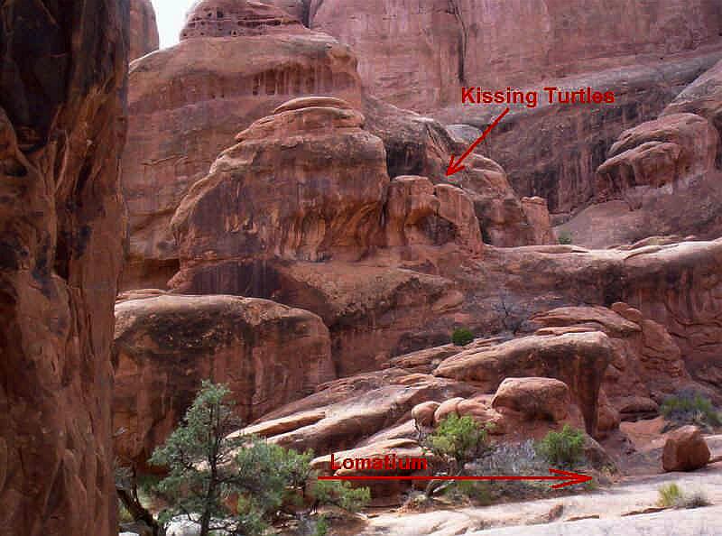
Video: Route Information: Beginning from the Kissing Turtles, head up to the drainage to the north (right). Stay at the base of the right-most fin as you're heading northwest, up canyon, and it will be hard to get lost.
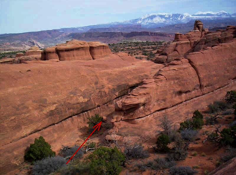
Below is the view from the Rock Garden where Kissing Turtles is located. You can see the correct drainage on the right.
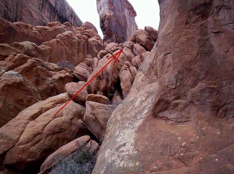
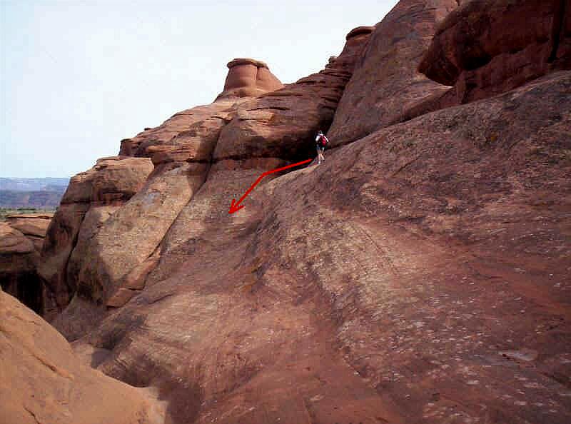
Continue up the drainage heading northwest. Route find you're easiest way while upclimbing. You'll come to a point that looks like the picture below. Stay to the right of the big fin in the middle of the rubble.
Keep
looking for a small saddle to your right as you upclimb. If you continue past the saddle
the hallway ends in a wall of very loose rubble that would be dangerous to upclimb. If you
reach the dangerous upclimb, you've gone too far. Retrace your path, the saddle is about
50-feet before the end of the hallway.
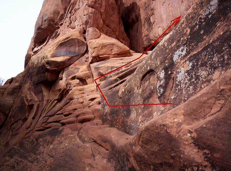
In the picture below is the view of the same saddle while looking down canyon.
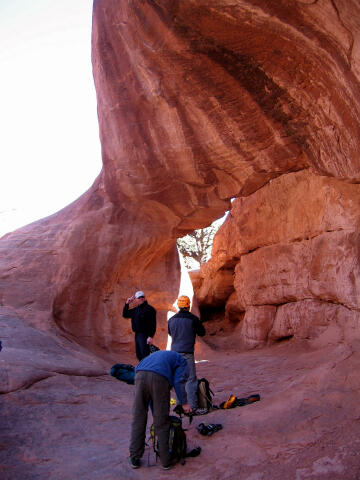
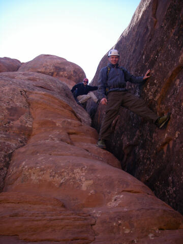
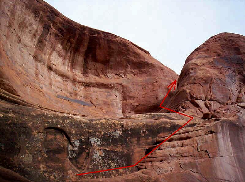
When standing in the saddle the view will look like the picture below. Climb through the crack and get on top of the fin. Once on top of the fins you have a great view of Arches National Park. You should be heading southeast with the La Salles Mountains on your left.
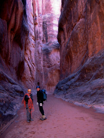
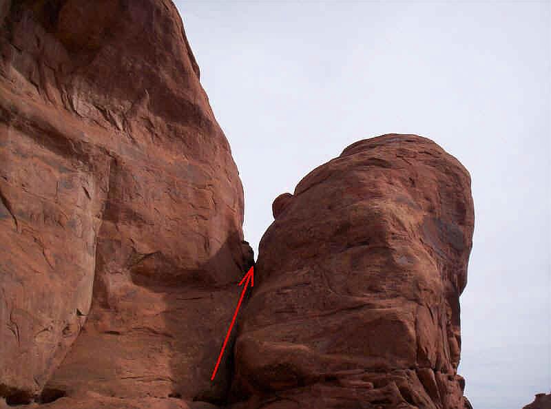
While traversing the fin look LDC (Left Down Canyon) and you will notice a small drainage that looks like the picture below. Find your way down off of the fin and snake your way into the drainage. There are several trails where the rain water has trickled its way into the drainage so do your best to stay off of the cryptobiotic soil. Once in the drainage you are at the head of Lomatium Canyon. Begin hiking downstream and its hard to get lost.
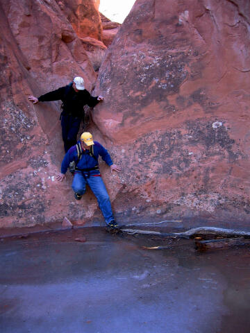
When hiking down Lomatium your view will look like the picture below. Near the canyoneer in the photo there is a crack that can be downclimbed, this will eliminate a short rappel. Beginners might require a little assistance getting into the crack.
A short distance beyond the crack you come to a rubble field on the right.
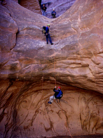
Rigging a rappel would be easy. However, there is a large boulder with a
hole under it that will accommodate everyone but the largest canyoneers. Once you rappel from
Abbey Arch, the canyon is basically over so take your sweet time. The second, and last,
rappel is only 150-yards away. The second rappel is 60-feet and has two bolted anchors. © Copyright 2000-, Climb-Utah.com |