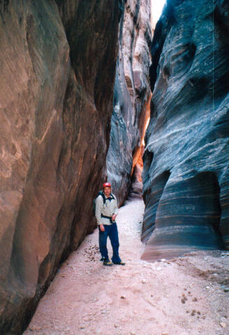
 Baptist Draw requires complete technical gear. The highest rappel in the slot is 65 feet and requires a 130-foot rope, several shoulder length slings, a couple of double length slings, 50 feet of webbing, several rapid links and a prusik system are required. Knee deep wading is not uncommon in the Baptist Draw portion of this route. Chute Canyon is one of those canyons with a liberal and varied personality. Because of it's large catch basin the immense flashfloods that roar through Upper Chute change it's personality each year. At times Upper Chute Canyon is completely dry, at other times the canyon will require several short sections of wading or swimming. When swimming holes develop in Chute Canyon they have a reputation of containing a really nasty soup made up of pinecones, pine needles, cow manure, dead mice and tree branches. A GPS is extremely useful. Good map reading skills and the USGS 7.5' Map titled "Horse Valley" are essential. Navigation for this route is difficult. The route involves several miles of cross-country navigation. All waypoints and maps for Baptist Draw use the WGS84 datum. Baptist Draw is rated 3B III using the Canyon Rating System. This canyon has a high flash flood danger on account of the large collection basin of Chute Canyon. Check the local weather report before entering this canyon. The entire drainage and a clear view of the western sky are visible before committing to this route. Historical Information: The Swasey family named a large portion of the canyons and features in the San Rafael Swell. Baptist Draw is believed to have received its name when Joe Swasey and a friend stopped for water at Baptist Tanks. The tanks are depressions or potholes in the sandstone that capture and hold water. The cowboys decided to baptize a dog, which had been following them by tossing him into the tanks.
A high clearance vehicle is advised for accessing this trailhead, four-wheel-drive is not required. The San Rafael Swell is criss-crossed with roads. Stay on the road described until told to turn off of it. From Green River, Utah follow I-70 west for 29 miles to the underpass at mile marker #131. From the cattle guard on the south side of the underpass, follow the graded dirt road signed U24/Goblin Valley/Temple Mountain, for 10.2 miles to the signed Red Canyon/Tan Seep junction. Take the right (west) fork for 3.8 miles to the signed Red Canyon/Mckay Flat junction. Turn right (west) and follow the road for 0.9 miles to the signed Mckay Flat junction. Take the left (south) fork for 3.8 miles to a cattle guard across the road. 150 yards south of the cattle guard there is an unmaintained track on the left (east). Follow this track for 2.8 miles to an unsigned fork in the road. Take the left (east) fork and continue for 0.6 miles and park anywhere you wish. This is the trailhead and there is no signed or established parking. There are plenty of good campsites in the juniper and cedar trees in the area. There is also a fun campsite and fantastic viewpoint of Chute Canyon if you continue following the track an additional 1.1 miles to its end.
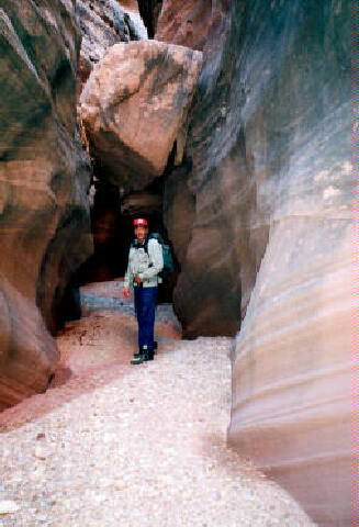
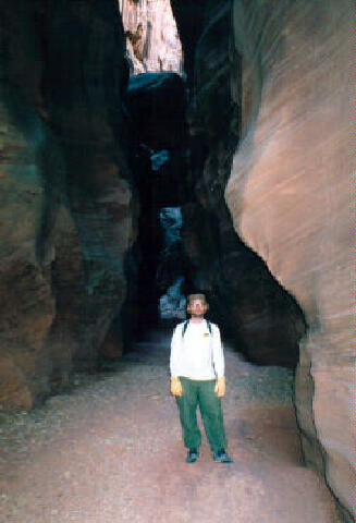
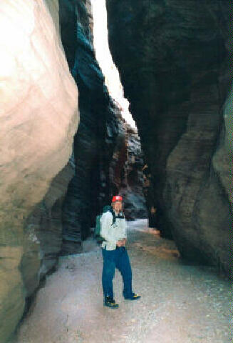
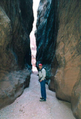
Before starting, It is a good idea to walk 100 yards south from the trailhead and look at the valley you must cross to finish the route. Carefully noting where you are standing will help you quickly navigate to your vehicle on the return hike. From the Baptist Draw Trailhead (N38° 41' 51", W110° 48' 23") walk northeast for 1/4 mile until you have a good view from the canyon rim. From the rim Identify Teepee Rock, which is an obvious and well-proportioned butte in the center of the valley. Use Teepee Rock to navigate into Baptist Draw. The route travels to the east side of Teepee Rock and than descends north into Baptist Draw. Once into Baptist Draw (N38° 42' 11", W110° 47' 43") head downstream and let the fun begin. The canyon begins to narrow up and get interesting after a short distance. The Baptist Draw Narrows are short and fun. There are several sections where you will need to remove your backpack to squeeze through. Near the end of Baptist Draw you will encounter the first rappel that is 20 feet from a chokestone. Baptist Draw ends with a 65-foot rappel into Upper Chute Canyon. The rappel is anchored from three bolts on the south (right) side of the canyon. From the junction of Baptist Draw and Chute Canyon (N38° 42' 06", W110° 47' 10") you can explore the upstream narrows for approximately 1 mile if you would like. This diversion will add 1 hour to your route. A couple of hundred feet downstream from the junction of Baptist Draw and Chute Canyon you will encounter an obstacle that was added during a massive flashflood in September of 2002. The obstacle is easy to conquer and consists of a huge canyon wide boulder. To give you an idea of the power of a flashflood this boulder was located a hundred feet above the Baptist Draw/Chute Canyon junction prior to the September 2002 flashflood. Just past the huge boulder you will likely encounter some downclimbing and the final rappel, which is 12 feet from a chokestone. This is also the section of Chute Canyon where water filled potholes have a big tendency to appear and disappear. Continue down Chute Canyon for nearly 3 miles enjoying the deep, narrow and very beautiful slot to the junction with Fault Line Canyon. The Fault Line Junction (N38° 40' 56", W110° 46' 37") is easy to locate. The high walls drop down and the canyon becomes wide with several trees in the bottom. Follow Fault Line Canyon west for 2 miles (approximately 1 hour) until and easy to identify junction (N38° 40' 59", W110° 48' 50") with a wash entering from the right (north). Follow the wash to the north and hike to the top of the mesa. Cross the top of the mesa heading north to the south rim of a valley. This is the same valley you checked out before the adventure began. If you did a good job of noting where you were standing earlier in the day it should help you now. Cross the valley to the trailhead on the opposite rim. Video: Related
Link:
© Copyright 2000-, Climb-Utah.com |
