[ Homepage ] [ Introduction ] [ Warning ] [ Ratings ] [ Ethics ] [ Feedback ] [ Updates ] Monte Cristo
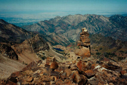
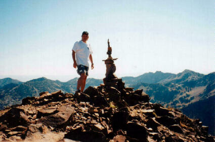
11,132' Climbing Mount Superior and Monte Cristo will result in an enjoyable day of scrambling. The mountains are relatively easy to summit for peaks which are over 11,000'. There is a controversy over which peak is actually Mount Superior. The USGS maps list the higher 11,132 summit as Mount Superior. The locals and early maps refer to the higher 11,132' summit as Monte Cristo and the shorter summit 1/4 mile east as Mount Superior. Since I am a local, I refer to the higher summit as Monte Cristo. It really doesn't matter which name you use since this route description includes the summit of both peaks. If you don't do both peaks you will really miss out on a bunch of fun and some great views at the cost of only a little extra effort. After climbing the first summit you have done all the hard work, the second higher summit is nothing more than a nice stroll.
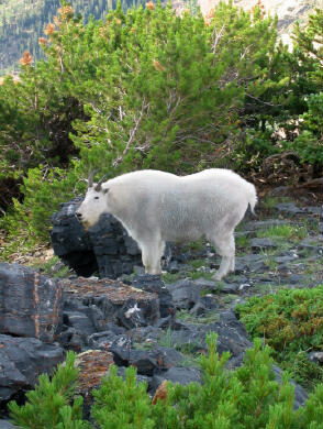
The summit of Mount Superior is 11,040; the summit of Monte Cristo is 11,132'. These peaks can be climbed in summer and fall by experienced hikers. This is also a popular winter and spring mountaineering route. An ice axe and crampons are highly recommended for anyone attempting the summits while there is still snow on the mountain. Reaching the summit of Mount Superior will require 2 1/2 hours. It will require an additional 20 minutes for the short hike over to the summit of Monte Cristo. This hike requires a fair amount of scrambling with moderate exposure. Navigation for this hike is easy. Mountain goats are often visable on this route to those who know where to look. Trailhead
Information: From the Y-Junction at the mouth of Little Cottonwood Canyon drive up canyon 8.2 miles and park near the Forest Service Garage on the left (north) side of the road. (N40 35' 25", W111 38' 15"). The Forest Service Garage is a stone faced building across the road from the Alta Lodge. Route Information: The
trailhead begins on the paved road on the east side of the Forest Service Garage. Walk
behind the Forest Service Garage and the road will fork. Take the right (east) fork
in the road which passes in front of the Alta Sheriff's Office. Follow the road for
approximately 200 yards to a spur road on the left. This spur leads to some
cabins. Continue hiking the main road for an additional 100 yards until you come to a
second spur road on the left. This is the road you want to take. The
trailhead begins on the paved road on the east side of the Forest Service Garage. Walk
behind the Forest Service Garage and the road will fork. Take the right (east) fork
in the road which passes in front of the Alta Sheriff's Office. Follow the road for
approximately 200 yards to a spur road on the left. This spur leads to some
cabins. Continue hiking the main road for an additional 100 yards until you come to a
second spur road on the left. This is the road you want to take.
Begin hiking up the spur road. The route is very easy to follow and not difficult to hike. There are several short cuts across switchbacks, but I always just hike the road. The route generally follows the power lines to Cardiff Pass. About 2/3 of the way to Cardiff Pass the route splits. The better right fork leads to the Flagstaff Mine and the left fork follows the power lines to Cardiff Pass (N40 35' 45", W111 39' 05"). From near this juntion the road turns into a well traveled trail, which winds through a meadow as it climbs toward Cardiff Pass. From Cardiff Pass follow the hiker made ridge trail west toward the summit of Mount Superior. In a short distance you will be rewarded with a great view of Mount Superior. Don't become intimidated looking at the summit, the route is easier than it looks. There are several ways to by-pass all obstacles. Just follow the hiker made trail to the summit. The easiest route is usually located 10 to 50 feet below the ridge on the Little Cottonwood Canyon side. From the summit of Mount Superior ( N40 35' 32", W111 40' 01") it is an easy hike over to Monte Cristo (N40 35' 29", W111 40' 17"). Again the route usually follows below the ridge on the Little Cottonwood Canyon side.
From the highway the route looks more difficult than it is. The route involves a tremendous amount of scrambling with several sections of major exposure. With good route finding skills and common sense you should never find yourself in an inescapable position. The rock is reliable with abundant handholds. Just stay on or near the ridge and the route should require less than 4 hours from road to summit. The exit is to walk off using the traditional hiker trail, which leads down to the town of Alta. The hike down will require approximately 1 1/2 hours. Nearly the entire route is visible from the tram deck at Snowbird. If you do this route during Octoberfest the crowds can follow your progress all the way to the summit. Afterwards you can enjoy beer with perhaps an autograph session at Snowbird. Optional Scrambling Route Trailhead: [ Homepage ] [ Introduction ] [ Warning ] [ Ratings ] [ Ethics ] [ Feedback ] [ Updates ] © Copyright 2000-, Climb-Utah.com |

 Optional Scrambling Route: