[ Homepage
] [ Introduction ] [ Warning ] [ Ratings
] [ Ethics ] [ Feedback ] [ Updates
]
 |
Kanarra
Creek
aka: Kanarra Falls
Zion
National Park
Canyoneering
Kanarra
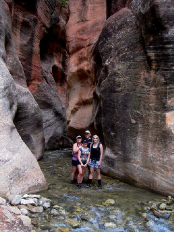
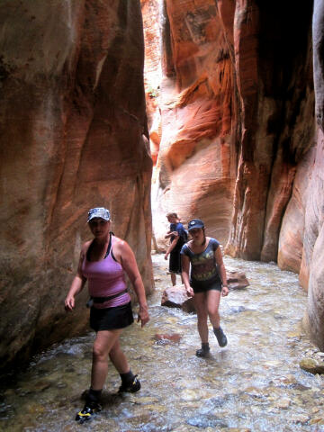
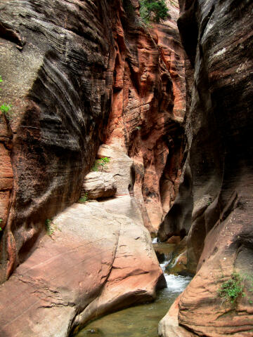
Creek offers dramatic scenery, majestic narrows, a fun hike, wading and a few scrambling
problems to spice up your adventure. Most novice hikers can easily visit the bottom portion of canyon. A
minor touch of climbing or athletic skill is required to visit the entire canyon.
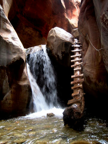
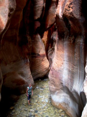
Kanarra
Creek is an extremely radiant and photogenic slot canyon located just outside the Kolob
Section of Zion National Park. The canyon offers an abundance of opportunities for the
shutterbug to get that perfect slot canyon photograph. |
General Information:
  Kanarra Creek is a semi-technical canyoneering adventure. This canyon is remarkably
photogenic. It is possible for novice hikers and families to visit the lower section of
slot canyon. Those who want to visit the entire canyon and upper slot will need at least
one experienced hiker or rock climber along to help defeat a few minor obstacles. This
route will require 4 hours to complete. You will need a 30-foot rope for hand lines, belays, lowering packs and possible emergency
use. I also suggest carrying a 30-foot length of webbing to replace the fixed handlines if
necessary.
Kanarra
Creek is the water supply for the town of Kanarraville. Please pick up all trash, avoid
all water pipes and keep the water clean or we will lose this route to hiking.
This canyon
is not accessible during spring run-off when water levels are high. Kanarra Creek requires
several miles of knee deep wading combined with a couple of sections of possible waist
deep wading. The water is cold and a hot day is suggested.
"Kanarraville" is the
USGS 7.5 minute topographical map that shows Kanarra Creek. Navigation for this adventure
is easy, but there is no established trail. All waypoints and maps for this route use the
WGS84 datum. You will be walking and wading in a canyon bottom.
Kanarra Creek is rated 2C II using
the Canyon Rating System. You do not need a Zion
backcountry permit for this canyon because it is located outside the National Park.
Kanarra Creek has a moderate flash flood danger.
Check the weather report before entering the slot canyon.
Permit
Information:
Hiking
permits are now required to visit Kanarra Creek. The permit fee includes
free parking at the Town of Kanarraville trailhead parking lot and is
non-refundable. Children age 3 and under are free and do not require a
ticket. Group or non-profit discounts are not offered. Bring your permit
with you the day of the hike.
"Kanarra Creek On-Line Permit"
Trailhead Information:
The Kanarra
Creek Trailhead is accessible to all vehicles in all weather conditions. The
road to the trailhead is paved. A car shuttle is not required for this
adventure. The trailhead consists of a large signed parking area with
toilets, information kiosk and picnic tables. There is a $10.00 fee (as of
2016) required for using the parking area. For those to cheap to pay you can
park at the Town Hall three blocks away on 40 South Main Street for free. Vehicles parked elsewhere or
not paying are booted or towed, you have been warned.
From the North:
From
I-15 near Kanarraville Utah, take Exit #51, signed Kanarraville. Follow the
highway south towards Kanarraville for 4.7 miles to the center of town. From
the intersection of Main Street and 100 North, turn east (left) on 100 North
and follow it for 0.3 miles until the road turns to dirt and is blocked by a
gate. The signed Kanarra Creek Trailhead is located near the gate on the
north (left) side of the road.
From the South:
From
I-15 near Kanarraville Utah, take Exit #42, signed Kanarraville & New
Harmony. Follow the highway north towards Kanarraville for 4.5 miles to the
center of town. From the intersection of Main Street and 100 North, turn
east (right) on 100 North and follow it for 0.3 miles until the road turns
to dirt and is blocked by a gate. The signed Kanarra Creek Trailhead is
located near the gate on the north (left) side of the road.
Route Information:
From
the Kanarra Creek Trailhead (N37° 32' 15", W113° 10' 33"), pass through the gate and follow
the dirt maintenance road up the hill for 1/4 mile to a large water tank
(N37° 32' 19", W113° 10' 24"). Keep following the maintenance road as it descends
for 1/4 mile to a stream crossing. After crossing the stream just keep
following the dirt road to a second crossing. After the second crossing the
maintenance road climbs to a fenced enclosure and ends (N37° 32' 17", W113° 09'
32").
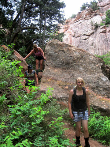
From the fenced enclosure follow the hiking trail heading east.
There are an abundance of different trails in the lower canyon but all roads
lead to Rome. It's nearly impossible to get lost since the creek flows out
of the slot canyon that is your destination. Just follow the
trail that works best for you. All the trails converge in the upper canyon the route
becomes easier.
Approximately 1 1/2 miles from the trailhead you will encounter the first section of slot
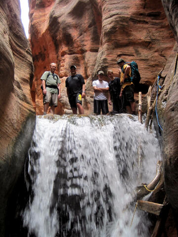
canyon (N37° 32' 17", W113° 09' 11"). It is rather impressive as the creek appears to burst from the massive sandstone
wall. Follow the creek and wade up through the first section of narrows. The head of the
narrows is guarded by a massive 15-foot chokestone that you must climb up and over. This
is normally the most difficult obstacle in the canyon. There is a knotted rope running between two
bolts on the south (right) canyon wall to help you defeat this obstacle. Care should be
used by the first person up to insure that the rope is in good condition. If not, please
consider replacing it and packing out the trashed rope.
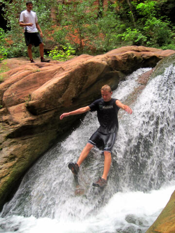
Above the massive chokestone the slot opens briefly with a couple
interesting sandstone pools, the upper most pool contains a fun
waterslide that drops you into the middle of the pool. Take a slide and have
some fun.
The canyon
remains extremely impressive as it slots up again above the waterslide and
pool. Just keep wading up stream and you will reach the second major obstacle in the canyon. This is a 10-foot rock
jam that you must again climb up and over. There is a rope running between two bolts on
the south (right) canyon wall to help you defeat this obstacle. Care should be used by the
first person up to insure that the rope is in good condition. If not, please consider
replacing it and packing out the trashed rope.
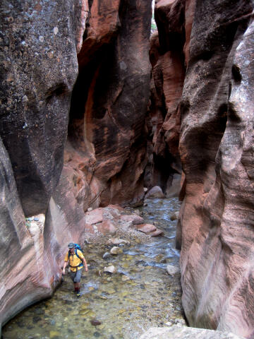
Once above
the second major obstacle you can hike up canyon as far as you desire. It is not long
before all signs of a trail disappear and you will be constantly hiking up the creek
bottom. It is an enjoyable stroll with changing scenery around every corner. Hike up
canyon as far as you desire and than return the way you came.
No Dogs Allowed:
PLEASE!!! do not take
your dog. This drainage is Kanarraville's drinking water. If the water
quality drops below the health department standard the canyon will be closed
to all visitors. The no dog rule is not because the town hates dogs, its to
protect the water supply.
Video:
Enjoy a short video
of Kanarra Creek. If this video fails to play on your mobile device or
computer you can always watch the
Original YouTube Version here.
[ Homepage
] [ Introduction ] [ Warning ] [ Ratings
] [ Ethics ] [ Feedback ] [ Updates
]
© Copyright
2000-, Climb-Utah.com |


