[ Homepage ] [ Introduction ] [ Warning ] [ Ratings
] [ Ethics ] [ Feedback ] [ Updates
]
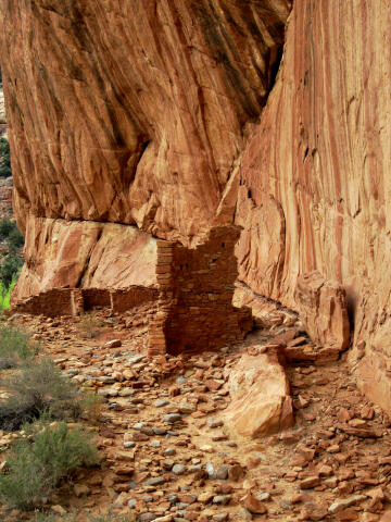 |
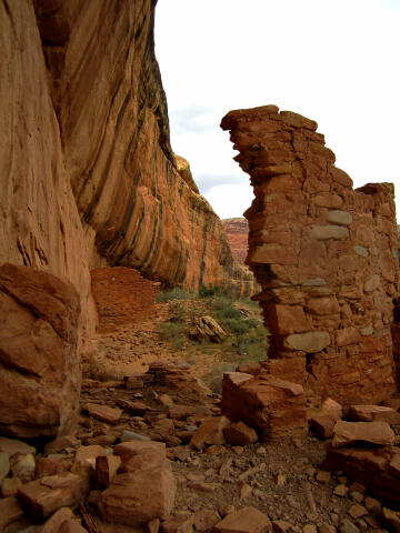
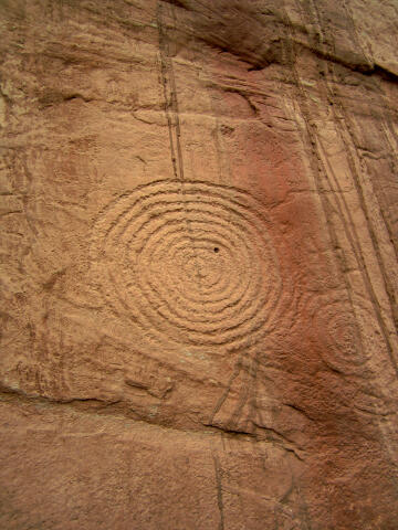
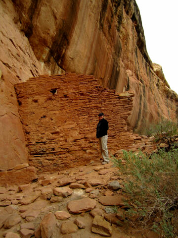
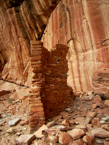
Arch Canyon Ruins
Cedar Mesa
Anasazi Ruins and Petroglyphs
Arch
Canyon contains several Anasazi (Ancestral Pueblo) ruins that are
easily accessible for the entire family. Please take only
pictures and leave only footprints. |
General Information:
 The major attraction of the Arch Canyon ruins is they are easily accessible
to everyone. Those with a high clearance vehicle can drive to the ruins, all
other will have to make a very short walk. A round trip to visit
and explore the ruins and rock art will require approximately 1 hour. This is a desert environment,
every member of your hiking party should carry a minimum of at least one liter of water.
Arch Canyon is accessible year round in good weather.
The major attraction of the Arch Canyon ruins is they are easily accessible
to everyone. Those with a high clearance vehicle can drive to the ruins, all
other will have to make a very short walk. A round trip to visit
and explore the ruins and rock art will require approximately 1 hour. This is a desert environment,
every member of your hiking party should carry a minimum of at least one liter of water.
Arch Canyon is accessible year round in good weather.
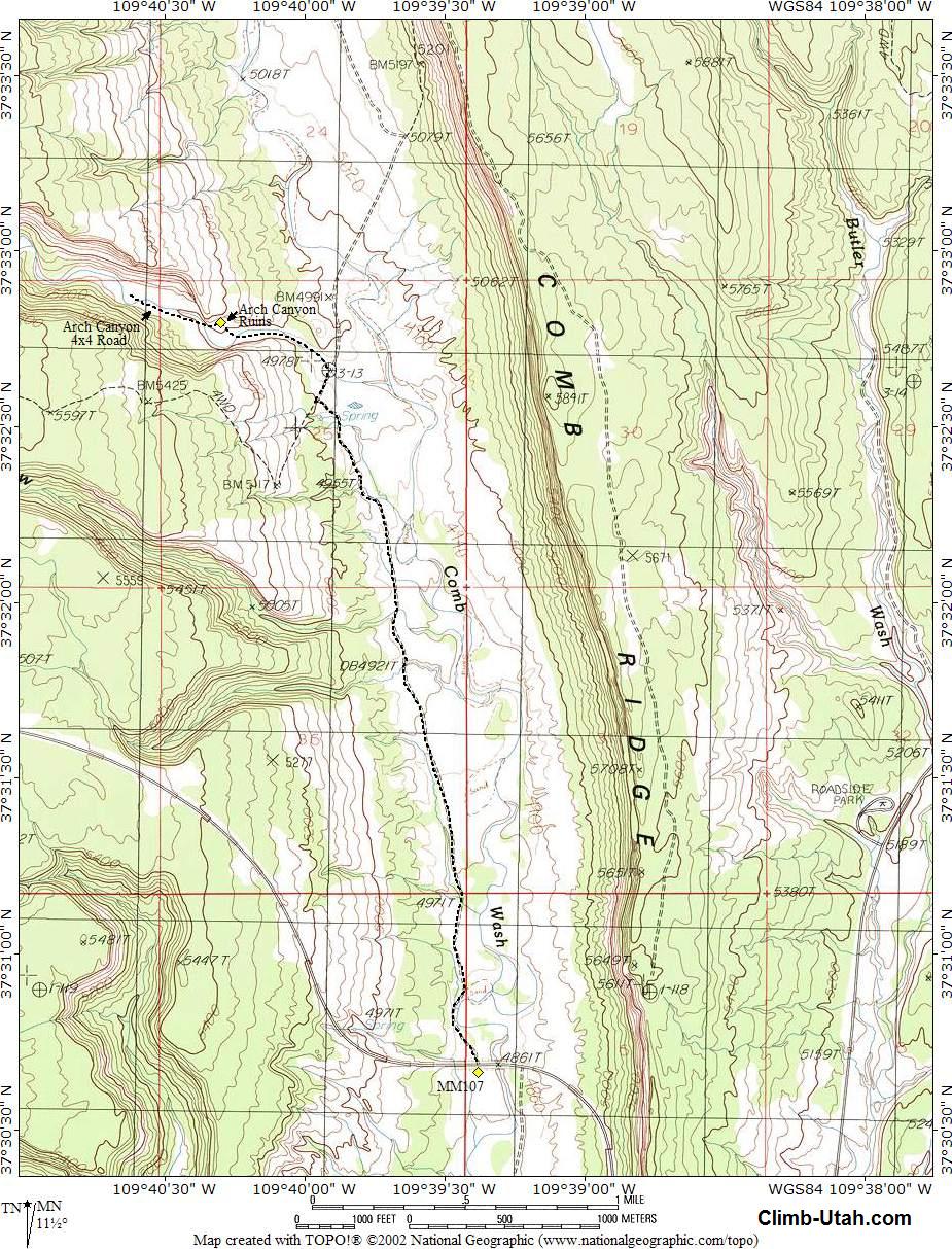
A GPS is useful in verifying you
are on the correct route. The USGS 7.5' Map titled "Hotel Rock" shows the area
described. Navigation for this route is easy. All waypoints and maps use the WGS84 datum.
Arch Canyon Ruins and petroglyphs are rated 1A I using the Canyon Rating System.
 |
 |
Trailhead Information:
This route is accessible to all vehicles in dry weather conditions. From Blanding, Utah travel
south on Utah Highway 191 for 3 miles to the junction of Utah Highway 191 and Utah Highway
95. Travel west 14 miles on
Utah Highway 95 to mile marker 107. At mile marker 107 (N37° 30' 41",
W109° 39' 23") turn north (right) on the
graded Comb Wash Road (SJC 205) and follow it for 2.3 miles to a junction
(N37° 32' 34", W109° 39' 58"). At this junction the Dog
Tanks Road heads south (left) and the Comb Wash Road continues north (right).
Turn north (right) and follow
the Comb Wash Road for 0.1 miles to a
junction (N37° 32' 40", W109° 39' 55").
At this junction the Arch Canyon Road heads west (left) and the Comb Wash
Road continues north (straight ahead). Those with passenger vehicles will
want to park here and walk the remain distance.
Turn west (left) and follow
the Arch Canyon Road 0.4 miles to the signed Arch Canyon Ruins
(N37° 32' 48", W109° 40' 18").
The ruins are located under the cliff on the north side of Arch Canyon. The
cliff walls behind the ruins are covered with petroglyphs.
Related Adventures:
A trip to the
Arch Canyon Ruins is usually combined with a visit to the
Beaver Pond Ruins and
Walnut Knob Petroglyph Panel. A visit to all three sites makes for a
great half-day adventure.
[ Homepage
] [ Introduction ] [ Warning ] [ Ratings ] [ Ethics
] [ Feedback ] [ Updates ]
© Copyright
2000-, Climb-Utah.com |