 The Subway (Left Fork of
North Creek) is a semi-technical canyoneering adventure. This route should only be
attempted when lead by an experienced hiker or canyoneer. The route will require 7 to 9
hours to complete. The payoff for your time and effort is visiting some of the most
spectacular scenery in Zion National Park, without the usual busload of tourists. I suggest a group size
of six or less. A car shuttle or hitching a ride is required
to complete the entire top down adventure.
The Subway (Left Fork of
North Creek) is a semi-technical canyoneering adventure. This route should only be
attempted when lead by an experienced hiker or canyoneer. The route will require 7 to 9
hours to complete. The payoff for your time and effort is visiting some of the most
spectacular scenery in Zion National Park, without the usual busload of tourists. I suggest a group size
of six or less. A car shuttle or hitching a ride is required
to complete the entire top down adventure.
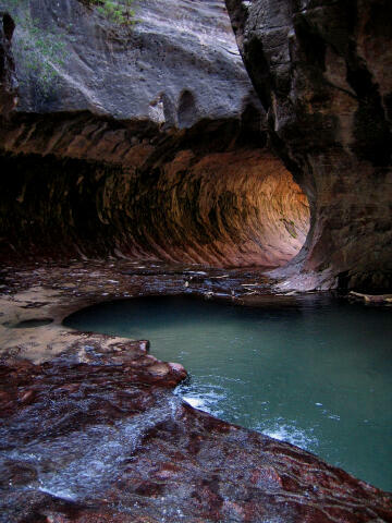
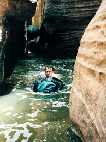
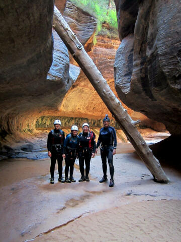
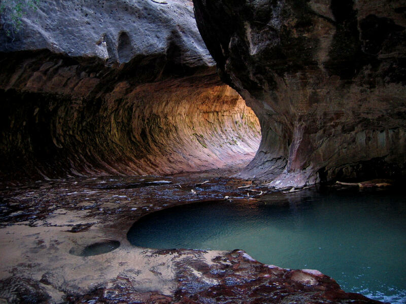
You will need a 60-foot rope for hand lines, belays, lowering packs and possible emergency use. Use a drybag for anything you don't want wet. The Subway contains several cold swims and miles of wading. Wetsuits are suggested for cold weather conditions. There are several downclimbing problems where inexperienced canyoneers might require a handline, belay or partner assist. You will need a Zion backcountry permit to enter the Subway (Left Fork of North Creek). The Subway is limited to 50 visitors per day. Permits can be reserved three month's in advance. The Subway is rated 2B III using the Canyon Rating System. Navigation for this adventure is moderate since there is no trail. The Guardian Angels, is the USGS 7.5 minute topographical map which shows the Subway. A GPS works in this canyon to identify all important route junctions and the exit trail. All waypoints and maps for this route use the WGS84 datum. The Subway and the Zion Narrows have a serious flash flood danger, check the weather report at the Visitor Center when you pick up your permit.The Subway requires advanced skills to descend in high water conditions. "Escaping the Subway" is an epic tale of one groups adventure during spring runoff conditions.
After picking up your Zion Backcountry Permit at the main Zion Canyon Visitor Center drive 14 miles west on Highway 9 to the town of Virgin. Turn north (right) on the signed Kolob Reservoir Road. Travel 8.1 miles to the signed Left Fork Trailhead. The trailhead is on the east (right) side of the road and contains a large dirt parking lot, pit toilet and information kiosk. The Left Fork Trailhead is where you will finish the route. Park a shuttle vehicle at this trailhead. Wildcat Trailhead: Both trailheads are reached by paved road and are accessible to any vehicle in good weather. Trailhead shuttle information is available.
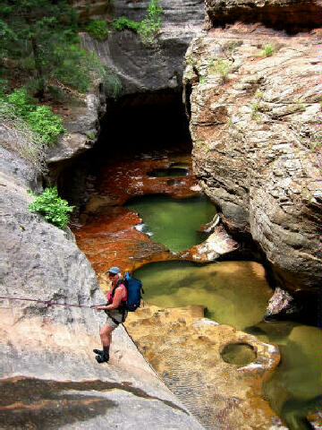
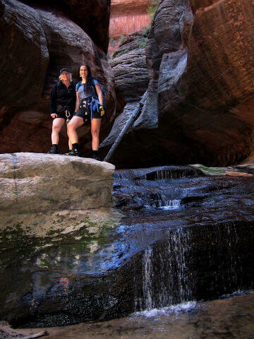
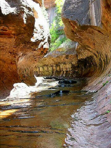
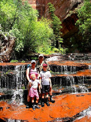
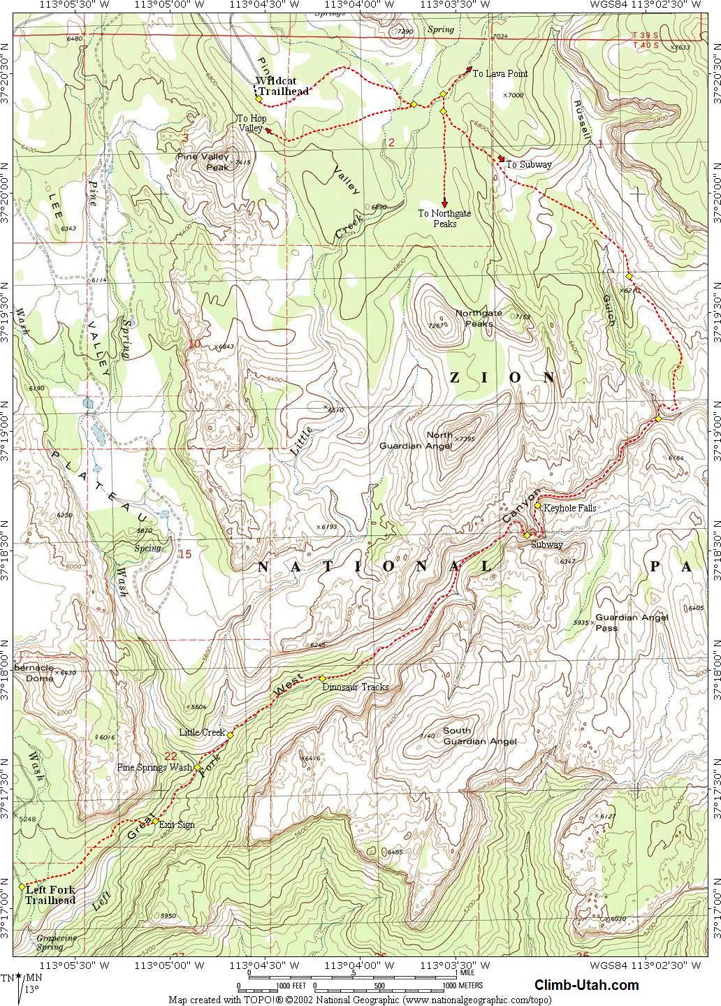
From the Wildcat Trailhead (N37° 20' 24", W113° 04' 32"), follow the trail east for 1 mile to a junction with the Wildcat Canyon Connector trail (N37° 20' 23", W113° 03' 43"), turn east (left) at the junction and follow the trail for 300 yards to the junction with the Northgate Peaks spur trail. (N37° 20' 25", W113° 03' 35"), turn south (right) and follow the Northgate Peaks spur trail south for 200 yards until you encounter a well defined hiker made trail (N37° 20' 21", W113° 03' 34") forking off to the east (left) and descending towards Russell Gulch. The trail is easy to find and is signed with information about "Permit required to descend Left Fork". Follow the prominent, unmaintained but well cairned trail for 1 1/4 miles to where the route reaches the floor of Russell Gulch, than climbs onto slickrock to the east. DO NOT descend Russell Gulch at this point, the route climbs out the east side and follows the slick rock. 1/2 mile beyond the floor of Russell Gulch the route crests through a slickrock saddle (N37° 19' 39", W113° 02' 35"). There is a large hoodoo in the center of the saddle. From the saddle it is 3/4 mile to where the route descends Left Fork canyon at the confluence of Russell Gulch and Left Fork (N37° 19' 07", W113° 02' 21"). The last 100-yards of trail that descends into the bottom of the actual canyon is down a steep dirt and rock covered trail, use caution. Follow Left Fork downstream as the obstacle course begins. The first major obstacle is a large boulder. Experienced canyoneers can downclimb (or rappel) the front of the boulder. There is a route around the north (right) side of the boulder that looks inviting but that is the worst of the options and requires an awkward rappel. The best way around the boulder is to look over against the south (left) canyon wall. If you look carefully you will notice a large hole that you can downclimb through. The hole is somewhat hidden and is overlooked by most parties, but finding the hole will make this obstacle easy to bypass. Crawl through the hole and you will find yourself standing in a large chamber. Scramble down to the bottom of the chamber and you will find anther large opening through some boulders. Crawl through the opening and you will find yourself standing in ankle deep water at the base of the large boulder that was your initial obstacle. This turns the boulder obstacle into an easy bypass, the two holes are not tight or difficult to crawl through. Continue downstream. There are several pools to swim. The longest swim is approximately 40-feet, bring drybags for your gear. There are several other obstacles above the Subway that must be waded or downclimbed. 1 mile below the junction of Russell Gulch and Left Fork you will encounter Keyhole Falls (N37° 18' 42", W113° 03' 05"). This is the upper end of The Subway. Keyhole falls will require a rope for a handline. Anchor the handline to the bolts on the north (right) side of the canyon. This should lead you into the beautiful Upper Subway section. Continue downstream and you will soon encounter anther small cliff that blocks most hikers coming up from the bottom. Historically hikers have walked across some logs to the south (left) side of the cliff and set up a handline from two easy to locate bolts, but a flashflood in 2013 washed out the logs and made it dangerous to reach the south side bolts. A set of easy to reach and locate bolts are now located on the north (right) side of the cliff, this option is now considered the safer choice. Either option will deposit you in the Lower Subway section. This is the end of the difficult obstacles. Explore the area, if you hike and swim back under the waterfall you will find a small hidden room. The actual Subway is only 1/4 mile long. 1/4 mile below Keyhole Falls you will exit the lower end of The Subway (N37° 18' 32", W113° 03' 07"). The remainder of the hike involves wading and boulder hopping. The canyon opens up and remains extremely scenic for the next couple of miles. The hike out contains several beautiful cascades over red rock formations, high sandstone cliffs and a lush, green canyon bottom. 1 1/2 miles below the Subway you will notice some excellent Dinosaur tracks (N37° 17' 58", W113° 04' 12") if you are paying attention. Several slabs of light gray mudstone are covered with dinosaur tracks. The stone is a fossilized lakebed from the Kayenta Formation, containing tracks laid down in the early Jurassic Period. The tracks belong to a bipedal carnivore. If you are looking at the ground you will not see the tracks. The slabs are located about 15 feet from the river, on the north side. There are 3 slabs approximately 30 feet wide by 20 high, tilted at a 45-degree angle. 1/2 mile below the dinosaur tracks Little Creek joins from the north (N37° 17' 43", W113° 04' 41"). 1/4 mile beyond Little Creek and Pine Springs Wash joins from the north (N37° 17' 35", W113° 04' 51"). 1/4 mile below Pine Springs Wash you must exit the canyon to the north (N37° 17' 22", W113° 05' 05"). The exit route is signed at the river "Left Fork Trailhead". The climb out has an elevation change of 400 feet as you climb up a very steep gully to the top of the lava cliffs. 3/4 mile after leaving the stream and after you have climbed out of the canyon the trail crosses Grapevine Wash. From Grapevine Wash it is only 200 yards to the Left Fork Trailhead (N37° 17' 05", W113° 05' 47").
For the less adventurous, the "Subway" can be completed as an out and back hike from the Left Fork Trailhead and is rated 2B III using the Canyon Rating System. This will require 6 to 8 hours and does not require a vehicle shuttle. All the semi-technical obstacles are located above the "Subway". Harder Optional
Route: Das Boot Entrance: Russell Gulch
Entrance:
Related Link:
Video:
© Copyright 2000-, Climb-Utah.com |